Category:Maps of Budapest by Joris Hoefnagel
Jump to navigation
Jump to search
Media in category "Maps of Budapest by Joris Hoefnagel"
The following 7 files are in this category, out of 7 total.
-
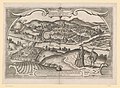
 Frans Hogenberg, Buda Citerioris Hungariae Caput Regni avita sedes 1617 (FL39696788 3699197).jpg 14,348 × 11,566; 240.53 MB
-

-
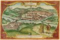 Buda Citerioris Hungariae Caput Regni avita sedes. vulgo Ofen 1617.jpg 1,500 × 1,010; 576 KB
-
 Braun & Hogenberg Buda in the 16. century.jpg 1,926 × 1,284; 1.17 MB
-
-
 Joris Hoefnagel Buda.jpg 5,260 × 3,563; 25.33 MB
-
 Theatri praecipvarvm totivs mvndi vrbivm - liber sextvs 1618 (97692446).jpg 15,438 × 10,336; 33.54 MB
.jpg)
.jpg)


,_RP-P-1911-3601.jpg)

.jpg)
Categories:
- Maps of Budapest by Braun & Hogenberg
- Maps and topographical views by Joris Hoefnagel
- Buda in the 1610s
- 1617 in Hungary
- Clothing of Hungary
- Costumes of the Ottoman Empire
- Bridges over the Danube in Budapest
- Margaret Island in art
- Gellért Hill in art
- Paintings with turbans
- Danube in Budapest in art
- Historical images of Danube
- People of the Ottoman Empire in art