Category:Maps of Bromsgrove District
Jump to navigation
Jump to search
Media in category "Maps of Bromsgrove District"
The following 7 files are in this category, out of 7 total.
-
 BROMSGROVE (49910742986).png 2,160 × 1,080; 250 KB
-
 Bromsgrove UK locator map.svg 1,425 × 1,262; 892 KB
-
 Bromsgrove UK ward map 2010 (blank).svg 1,345 × 1,266; 418 KB
-
 Bromsgrove UK ward map 2015 (blank).svg 1,345 × 1,266; 535 KB
-
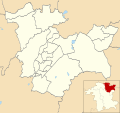
 Bromsgrove unparished area UK locator map.svg 1,345 × 1,266; 389 KB
-
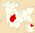
 Rubery unparished area UK locator map.svg 1,345 × 1,266; 389 KB
-
 WorcestershireBromsgrove.png 200 × 176; 14 KB
.png)


.svg)
.svg)