Category:Maps of British West Florida
Jump to navigation
Jump to search
Media in category "Maps of British West Florida"
The following 11 files are in this category, out of 11 total.
-
 Map of British West Florida showing 1763 and 1764 boundaries.jpg 600 × 398; 45 KB
-
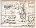 1763 Gibson Map of East and West Florida - Geographicus - Florida-GM-1763.jpg 3,081 × 2,374; 1.18 MB
-
 A draught of West Florida, from Cape St. Blaze to the River Iberville.jpg 11,934 × 4,971; 27 MB
-

-
 BritishWestFlorida1776.jpg 1,752 × 908; 597 KB
-
 Map Of West Florida.jpg 800 × 485; 27 KB
-
 Map to Illustrate the Acquisition of West Florida-es.svg 1,702 × 760; 711 KB
-
 Map to Illustrate the Acquisition of West Florida.jpg 1,232 × 879; 368 KB
-
 NorthAmerica1762-83.png 787 × 600; 90 KB
-
 West Florida Map 1767.jpg 448 × 280; 33 KB
-
 Westfloridaitsre00cham 0010.jpg 2,616 × 1,920; 456 KB


