Category:Maps of British Kaffraria
Jump to navigation
Jump to search
Media in category "Maps of British Kaffraria"
The following 9 files are in this category, out of 9 total.
-
 Eastern Frontier, Cape of Good Hope, ca 1835.png 836 × 733; 279 KB
-
 1855 Colton Map of Southern Africa - Geographicus - AfricaSouth-c-1855.jpg 4,000 × 3,257; 2.26 MB
-
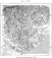
 AFR V4 D223 Kafirland.png 1,820 × 2,338; 1.85 MB
-
 AFR V4 D230 South Kafirland.png 1,743 × 1,961; 1.69 MB
-
 Africa (Southern Sheet) - DPLA - 66b808f00770a310f33b2e0d39f6b00b.jpg 1,000 × 810; 182 KB
-
 Africa Southern Sheet - DPLA - 39dcfc4f7e5458815d4b7c9d6c0719d9.jpg 1,000 × 762; 208 KB
-
 Süd-Africa mit Madagascar.jpg 5,738 × 4,616; 6.65 MB
-

-
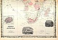 Colton and Johnson Johnson's Africa 1862 UTA (bottom).jpg 3,772 × 2,614; 5.67 MB


_-_DPLA_-_66b808f00770a310f33b2e0d39f6b00b.jpg)


_(14761876926).jpg)
.jpg)