Category:Maps of Brest, France by Le Tendre
Jump to navigation
Jump to search
Media in category "Maps of Brest, France by Le Tendre"
The following 2 files are in this category, out of 2 total.
-
 7FI 00069 Plan de la ville et des environs de Brest.jpg 2,550 × 3,436; 5.64 MB
-
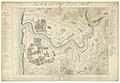 Plan de la ville et du port de Brest - (Signé Le Tendre, à Brest, 1820) - btv1b530299116.jpg 11,268 × 7,818; 11.16 MB

_-_btv1b530299116.jpg)