Category:Maps of Bouleternère
Jump to navigation
Jump to search
Wikimedia category | |||||
| Upload media | |||||
| Instance of | |||||
|---|---|---|---|---|---|
| Category combines topics | |||||
| Bouleternère | |||||
commune in Pyrénées-Orientales, France    | |||||
| Pronunciation audio | |||||
| Instance of | |||||
| Location | |||||
| Head of government |
| ||||
| Population |
| ||||
| Area |
| ||||
| Elevation above sea level |
| ||||
| official website | |||||
 | |||||
Media in category "Maps of Bouleternère"
The following 10 files are in this category, out of 10 total.
-
 66023-Bouleternère-argile.png 4,076 × 3,307; 3.98 MB
-
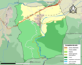
 66023-Bouleternère-Natura2000.png 5,846 × 4,133; 6.51 MB
-
 66023-Bouleternère-Routes-Hydro.png 3,507 × 2,480; 541 KB
-
 66023-Bouleternère-Sols.png 3,270 × 2,598; 1.5 MB
-
 66023-Bouleternère-ZNIEFF1.png 3,057 × 2,480; 4.21 MB
-
 66023-Bouleternère-ZNIEFF2.png 3,519 × 2,480; 4.54 MB
-
 66023-Bouleternère-Zone inondable.png 4,677 × 3,307; 5.6 MB
-
 Bulaterneta el 1812.png 395 × 342; 251 KB
-
 Localització de Bulaternera respecte del Rosselló.svg 487 × 522; 365 KB
-
 Map commune FR insee code 66023.png 756 × 605; 58 KB


