Category:Maps of Bora Bora
Jump to navigation
Jump to search
Media in category "Maps of Bora Bora"
The following 18 files are in this category, out of 18 total.
-
 Bora Bora without Tupai topographic map - with communes associées.png 998 × 634; 158 KB
-
 BoraBora without Tupai topographic map-fr.png 998 × 634; 149 KB
-

-
 263 of '(A class book of physical geography.)' (11084480174).jpg 617 × 732; 141 KB
-

-

-
 265 of '(A class book of physical geography.)' (11097555213).jpg 592 × 723; 113 KB
-
 Admiralty Chart No 1060 Huahine to Maupiti, Published 1960.jpg 16,425 × 11,303; 23.44 MB
-
 Admiralty Chart No 1107 Plans in the Iles de la Societe, Published 1972.jpg 16,344 × 11,260; 29.98 MB
-
 Admiralty Chart No 1428 Borabora Island, Published 1890.jpg 8,192 × 11,078; 10.93 MB
-
 Bora Bora Kingdom.svg 711 × 250; 68 KB
-
 Bora-Bora cropped from Admiralty Chart No 1107 Plans in the Iles de la Societe, Published 1972.jpg 7,861 × 10,136; 13.17 MB
-
 Bora-Bora-Commune.png 878 × 614; 12 KB
-
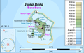
 BoraBora topographic map-fr.svg 714 × 923; 531 KB
-
 BoraBora2021OSM.png 5,555 × 5,997; 8.07 MB
-
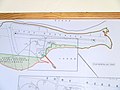 BORABORAairportmap.JPG 3,264 × 2,456; 1.77 MB
-
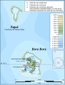
 Map of Borabora.jpg 1,729 × 2,529; 638 KB
-
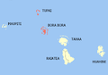
 Societe isl BoraBora.PNG 447 × 211; 6 KB


.jpg)
%27_(11084480174).jpg)
.jpg)
.jpg)
%27_(11097555213).jpg)


