Category:Maps of Bleskensgraaf en Hofwegen
Jump to navigation
Jump to search
Wikimedia category | |||||
| Upload media | |||||
| Instance of | |||||
|---|---|---|---|---|---|
| Category combines topics | |||||
| Bleskensgraaf en Hofwegen | |||||
former municipality in South Holland, Netherlands   | |||||
| Instance of |
| ||||
| Location |
| ||||
| Population |
| ||||
 | |||||
Media in category "Maps of Bleskensgraaf en Hofwegen"
This category contains only the following file.
-
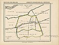 Bleskensgraaf en Hofwegen, Gemeenteatlas van Nederland.jpg 2,756 × 2,099; 1.14 MB
