Category:Maps of Blackpool
Jump to navigation
Jump to search
Wikimedia category | |||||
| Upload media | |||||
| Instance of | |||||
|---|---|---|---|---|---|
| Category combines topics | |||||
| Blackpool | |||||
town in Lancashire, England   | |||||
| Instance of | |||||
| Location | Blackpool, Lancashire, North West England, England | ||||
| Population |
| ||||
| Area |
| ||||
| Elevation above sea level |
| ||||
| Different from | |||||
| official website | |||||
 | |||||
Subcategories
This category has only the following subcategory.
P
Media in category "Maps of Blackpool"
The following 38 files are in this category, out of 38 total.
-
 48 of 'Blackpool. (A guide-book.)' (11242914753).jpg 1,256 × 1,885; 399 KB
-
 52 of 'Blackpool. (A guide-book.)' (11243027785).jpg 2,000 × 1,254; 442 KB
-
 72 of 'Blackpool. (A guide-book.)' (11240704715).jpg 2,160 × 1,459; 500 KB
-
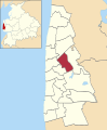
 Anchorsholme ward map 2010.svg 1,079 × 1,305; 197 KB
-
 Bispham ward map 2010.svg 1,079 × 1,305; 197 KB
-
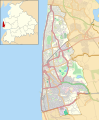
 BLACKPOOL (49910743326).png 2,160 × 1,080; 334 KB
-
 Blackpool 2007 election map.png 258 × 480; 34 KB
-
 Blackpool Council election 2011 map.svg 1,079 × 1,305; 197 KB
-
 Blackpool in the UK.png 325 × 491; 40 KB
-
 Blackpool local election 2003 map.svg 1,079 × 1,305; 197 KB
-
 Blackpool UK local election 2007 map.svg 1,079 × 1,305; 197 KB
-
 Blackpool UK locator map.svg 1,116 × 1,305; 1.25 MB
-
 Blackpool UK ward map 2010 (blank).svg 1,079 × 1,305; 196 KB
-
 BlackpoolNorthCleveleys2007Constituency.svg 253 × 314; 164 KB
-
 BlackpoolNorthFleetwoodConstituency.svg 240 × 285; 55 KB
-
 BlackpoolSouthConstituency.svg 240 × 285; 55 KB
-
 Bloomfield ward map 2010.svg 1,079 × 1,305; 198 KB
-
 Brunswick ward map 2010.svg 1,079 × 1,305; 197 KB
-
 Claremont ward map 2010.svg 1,079 × 1,305; 197 KB
-
 Clifton ward map 2010.svg 1,079 × 1,305; 198 KB
-
 EnglandBlackpool.png 200 × 247; 33 KB
-
 Greenlands ward map 2010.svg 1,079 × 1,305; 197 KB
-
 Hawes Side ward map 2010.svg 1,079 × 1,305; 198 KB
-
 Highfield ward map 2010.svg 1,079 × 1,305; 198 KB
-
 Ingthorpe ward map 2010.svg 1,079 × 1,305; 197 KB
-
 LancashireBlackpool.png 200 × 250; 3 KB
-
 Layton ward map 2010.svg 1,079 × 1,305; 197 KB
-
 Location map United Kingdom Blackpool.svg 1,079 × 1,305; 1.9 MB
-
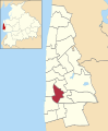
 Marton ward map 2010.svg 1,079 × 1,305; 198 KB
-
 Norbreck ward map 2010.svg 1,079 × 1,305; 197 KB
-
 Park ward map 2010.svg 1,079 × 1,305; 197 KB
-
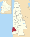
 Squires Gate ward map 2010.svg 1,079 × 1,305; 198 KB
-
 Stanley ward map 2010.svg 1,079 × 1,305; 198 KB
-
 Talbot ward map 2010.svg 1,079 × 1,305; 197 KB
-
 Tyldesley ward map 2010.svg 1,079 × 1,305; 198 KB
-
 Victoria ward map 2010.svg 1,079 × 1,305; 198 KB
-
 Warbreck ward map 2010.svg 1,079 × 1,305; 197 KB
-
 Waterloo ward map 2010.svg 1,079 × 1,305; 198 KB
%27_(11242914753).jpg)
%27_(11243027785).jpg)
%27_(11240704715).jpg)


.png)


.svg)