Category:Maps of Bismarck Archipelago
Jump to navigation
Jump to search
Subcategories
This category has the following 2 subcategories, out of 2 total.
M
- Maps of New Ireland (8 F)
Media in category "Maps of Bismarck Archipelago"
The following 48 files are in this category, out of 48 total.
-
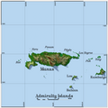
 00-307 Admiralty Manus.png 2,013 × 1,416; 294 KB
-
 00-375 Lihir Island.png 711 × 1,018; 143 KB
-
 1957 Map of Baluan Island.png 3,818 × 3,093; 30.15 MB
-

-
 Admirallty Chart No 1105 English Cove and Gower Harbour, New Britain, Published 1781.jpg 3,136 × 4,040; 2.35 MB
-
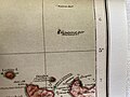
 Admiralty Chart No 2015 Plans in the Bismarck Archipelago, Published 1909.jpg 7,512 × 4,994; 5.27 MB
-
 Admiralty Chart No 2766 North-east Coast of New Guinea, Published 1866, Large Corrections 1938.jpg 16,275 × 11,077; 48.73 MB
-
 Admiralty Chart No 3519 Bismarck Archipelago Duke of York Group, Published 1905.jpg 8,460 × 12,096; 14.98 MB
-
 Admiralty Chart No 3553 Gazelle Peninsula and St George's Channel, Published 1909.jpg 12,360 × 8,592; 17.39 MB
-
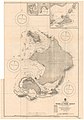
 Admiralty Chart No 3723 Hermit Islands. Published 1909.jpg 8,476 × 6,245; 5.47 MB
-
 Admiralty Chart No 3829 Plans in the Admiralty and Hermit Islands, Published 1934.jpg 8,460 × 12,203; 16.85 MB
-

-
-
 Admiralty Islands Topography with labels.png 2,554 × 1,328; 564 KB
-
 Admiralty Islands.png 5,400 × 5,400; 4.52 MB
-
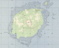
 AmbitleTopography.png 1,052 × 796; 65 KB
-
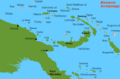
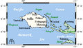
 Bismarck Archipelago within Papua New Guinea provinces (numbers) 2012.png 1,114 × 750; 114 KB
-
 Duke of York Islands Pos.png 700 × 584; 31 KB
-
 Duke of York Islands.png 1,000 × 864; 66 KB
-
 Duke of York Islands.svg 1,000 × 864; 32 KB
-
 Emirau and Kavieng.png 633 × 844; 77 KB
-
 Emirau EVS map.jpg 1,240 × 904; 294 KB
-
 Emirau.xcf 633 × 844; 210 KB
-
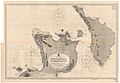
 Feni Islands-txu-oclc-6552576-sb56-3.jpg 966 × 613; 476 KB
-
 Garove map by British Admiralty Naval Intelligence Division 1943-1945.jpg 1,408 × 993; 191 KB
-
 German Oceania, 1914.jpg 1,094 × 876; 224 KB
-

-
 Karta PG Bismarck Archipelago Western Islands.png 725 × 475; 17 KB
-
 Karta PG Bismarck Archipelago.PNG 725 × 475; 16 KB
-
 Karte aus dem Deutschen Kolonialatlas mit den Baining Bergen.jpg 1,072 × 755; 171 KB
-
 Karte von Neu-Lauenburg.jpg 4,032 × 3,024; 2.01 MB
-

-
 Los Negros Locator Map.jpg 465 × 270; 40 KB
-
 Manam-txu-oclc-6552576-sb55-1.jpg 909 × 875; 573 KB
-
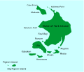
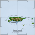 Manus Island.png 5,400 × 5,400; 5.91 MB
-
 Manus Plate map-fr.png 294 × 234; 104 KB
-
 NewHanoverOMC.png 528 × 309; 9 KB
-
 NewIreland2022OSM.png 5,255 × 3,914; 7.15 MB
-
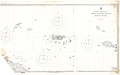
 Ninigo map.jpg 771 × 385; 37 KB
-
 Operationcartwheel.jpg 508 × 300; 32 KB
-
 Pacific Ocean laea Oceanian countries map.jpg 1,165 × 1,070; 542 KB
-
 Papua new guinea manus province.png 696 × 469; 56 KB
-
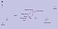
 Para-Micronésie.png 725 × 475; 20 KB
-
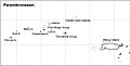 Paramikronesien Map.jpg 1,034 × 524; 59 KB
-
 Tanga Islands nla.obj-233138948-1 (cropped).jpg 1,186 × 976; 692 KB
-
 Tanga Islands nla.obj-233138948-1.jpg 5,000 × 4,148; 10.61 MB
-
 Txu-oclc-6552576-sb56-3.jpg 5,000 × 3,783; 4.17 MB
-
 Wirbelwind Riff Papua Neuguinea.jpg 4,032 × 3,024; 3.35 MB


.jpg)


_2012.png)


_Island_and_Cape_St_George_Cropped_from_Admiralty_Chart_No_2015_Plans_in_the_Bismarck_Archipelago,_Published_1909.jpg)


.jpg)


%27_(16403089420).jpg)