Category:Maps of Big Sur
Jump to navigation
Jump to search
Use the appropriate category for maps showing all or a large part of Big Sur. See subcategories for smaller areas:
| If the map shows | Category to use |
|---|---|
| Big Sur on a recently created map | Category:Maps of Big Sur or its subcategories |
| Big Sur on a map created more than 70 years ago | Category:Old maps of Big Sur or its subcategories |
| the history of Big Sur on a recently created map | Category:Maps of the history of Big Sur or its subcategories |
| the history of Big Sur on a map created more than 70 years ago | Category:Old maps of the history of Big Sur or its subcategories |
Wikimedia category | |||||
| Upload media | |||||
| Instance of | |||||
|---|---|---|---|---|---|
| Category combines topics | |||||
| Big Sur | |||||
region of the central coast of California, United States   | |||||
| Instance of | |||||
| Part of |
| ||||
| Location | California, Pacific States Region | ||||
 | |||||
Media in category "Maps of Big Sur"
The following 19 files are in this category, out of 19 total.
-
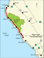 BigSurMap.png 536 × 707; 91 KB
-
 BigSurMap3.png 536 × 707; 94 KB
-
 1921 Los Burros mining district.png 1,261 × 787; 2.32 MB
-
 93920 ZCTA 2000 Census.png 575 × 425; 27 KB
-
 Alfred Clark 1906 land patent.png 615 × 329; 323 KB
-
 Andersoncanyonhistorical.jpg 373 × 274; 25 KB
-
 Big Sur and Los Padres National Forest.png 2,695 × 2,912; 7.67 MB
-
 Big Sur Empty.png 298 × 321; 84 KB
-
 Big Sur Main Roads and State Parks.png 1,200 × 1,293; 854 KB
-
 Big Sur State Parks.png 1,200 × 1,293; 841 KB
-
 BigSurMap2.png 536 × 707; 93 KB
-
 BottchersGap.png 336 × 336; 189 KB
-
 Camp-pico-blanco-california-vicinity-map.png 853 × 900; 198 KB
-
 Diseño del Rancho San José y Sur Chiquito 1853.jpg 1,400 × 753; 122 KB
-
 Palo Colorado diseno closeup.jpg 405 × 406; 84 KB
-
 Rancho el Sur 1898.png 1,918 × 1,561; 5.36 MB
-
 Rancho El Sur.jpg 704 × 573; 83 KB
-
 Rancho San Jose y Sur Chiquito 1898.png 1,294 × 2,401; 5.84 MB
-
 Soberanes fire 2016 10 11.jpg 8,967 × 11,955; 7 MB


