Category:Maps of Bessines-sur-Gartempe
Jump to navigation
Jump to search
Wikimedia category | |||||
| Upload media | |||||
| Instance of | |||||
|---|---|---|---|---|---|
| Category combines topics | |||||
| Bessines-sur-Gartempe | |||||
commune in Haute-Vienne, France    | |||||
| Instance of | |||||
| Named after | |||||
| Location |
| ||||
| Located in or next to body of water | |||||
| Population |
| ||||
| Area |
| ||||
| Elevation above sea level |
| ||||
| official website | |||||
 | |||||
Media in category "Maps of Bessines-sur-Gartempe"
The following 8 files are in this category, out of 8 total.
-
 87014-Bessines-sur-Gartempe-argile.jpg 3,057 × 2,480; 1.24 MB
-
 87014-Bessines-sur-Gartempe-Hydro.png 3,507 × 2,480; 9.33 MB
-
 87014-Bessines-sur-Gartempe-Sols.png 3,270 × 2,598; 4.15 MB
-
 87014-Bessines-sur-Gartempe-ZNIEFF1.png 3,519 × 2,480; 3.72 MB
-
 87014-Bessines-sur-Gartempe-ZNIEFF2.png 5,866 × 4,133; 18.78 MB
-
 Carte du marquisat de Magnac.jpg 4,481 × 3,385; 5.18 MB
-
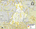
 Commune de Bessines-sur-Gartempe.png 776 × 844; 142 KB
-
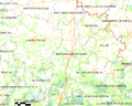 Map commune FR insee code 87014.png 756 × 605; 113 KB


