Category:Maps of Bergensbanen
Jump to navigation
Jump to search
Media in category "Maps of Bergensbanen"
The following 67 files are in this category, out of 67 total.
-
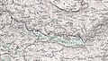
 Bergensbanen 00Kart1 Plan1885 no-nb digikart 21g063816 (cropped).jpg 2,564 × 2,294; 1.02 MB
-

-
 Kart over Bergensbanen 1924.png 2,607 × 1,899; 3.83 MB
-
 Bergensbanen km060 Topographic map of Norway, G34 vest Jevnaker, 1958 (cropped).jpg 3,298 × 2,058; 1.97 MB
-
 Bergensbanen km110 KR Topographic map of Norway, F34 Krøderen, 1919 (cropped.jpg 4,583 × 2,927; 4.95 MB
-
 Bergensbanen km140 Topographic map of Norway, F33 vest Flå, 1946 (cropped).jpg 3,251 × 2,095; 2.6 MB
-
 Bergensbanen km200 Topographic map of Norway, E33 vest Tunnhovd, 1941 (cropped).jpg 1,841 × 2,450; 1.74 MB
-
 Bergensbanen km210 Topographic map of Norway, E32 aust Gol, 1954 (cropped).jpg 2,203 × 1,240; 902 KB
-
 Bergensbanen km230 Topographic map of Norway, E33 vest Dagali, 1954 (cropped).jpg 3,235 × 1,820; 2.15 MB
-
 Bergensbanen km250 Topographic map of Norway, D33 aust Hallingskarvet, 1931 (cropped).jpg 2,861 × 1,610; 1.35 MB
-

-
 Bergensbanen km300 Topographic map of Norway, D33 vest Hardangerjøkulen, 1932 (cropped).jpg 3,247 × 1,824; 1.79 MB
-
 Bergensbanen km340 Topographic map of Norway, C32 aust Flåmsdalen, 1964 (cropped).jpg 3,211 × 1,807; 1.49 MB
-
 Bergensbanen km380 Topographic map of Norway, C33 vest Voss, 1974 (cropped).jpg 2,241 × 1,259; 857 KB
-
 Oversigtskart over Vossebanen - no-nb krt 00940.jpg 10,652 × 8,739; 21.7 MB
-
 Bergensbanen km402v Topographic map of Norway, B33 aust vest Bergsdalen, 1962 (cropped).jpg 6,222 × 3,790; 5.93 MB
-
 Bergens by nr 22- Kart over Bergen, 1885.jpg 5,568 × 6,651; 11.64 MB
-
 Bergen-omegn-1907.png 1,184 × 1,906; 816 KB
-
 Bergens by nr 27- Bergen med omegn, 1907 (detail1).jpg 1,920 × 1,080; 917 KB
-
 Bergens by nr 27- Bergen med omegn, 1907.jpg 7,713 × 9,627; 19 MB
-
 Bolstadfjorden-Vossebanen - no-nb krt 00940 (cropped).jpg 2,188 × 1,450; 1.18 MB
-
 Gamle Vossebanen map.jpg 1,400 × 924; 2.37 MB
-
 Generalkart VII, Bergen, 1925.jpg 6,478 × 5,688; 8.11 MB
-
 Generalkart VIII, Fagernes, 1929.jpg 6,366 × 5,696; 9.65 MB
-
 Omegnskart Bergen omland 4, 1931.jpg 5,816 × 7,652; 8.62 MB
-
 Omegnskart Bergen omland 6, 1934.jpg 5,937 × 8,082; 9.2 MB
-
 Omegnskart Bergen omland 6, 1947.jpg 6,072 × 7,452; 9.08 MB
-
 Omegnskart Bergen omland 6, 1964.jpg 6,215 × 7,636; 10.44 MB
-
 Rektangelkart Bergen 16D, 1912 - 2.jpg 6,846 × 5,887; 8.02 MB
-
 Rektangelkart Hønefoss 19B, 1939 - 1.jpg 6,811 × 5,211; 8.18 MB
-
 Rektangelkart Voss 23A, 1911 - 2.jpg 6,752 × 5,699; 8.4 MB
-
 Topographic map of Norway, B33 aust Bergsdalen, 1941.jpg 4,359 × 4,983; 4.94 MB
-
 Topographic map of Norway, B33 aust Bergsdalen, 1962.jpg 4,496 × 4,967; 5.03 MB
-
 Topographic map of Norway, B33 vest Bergen, 1938.jpg 4,331 × 4,881; 4.79 MB
-
 Topographic map of Norway, B33 vest Bergen, 1950.jpg 4,384 × 4,991; 5.13 MB
-
 Topographic map of Norway, B33 vest Bergen, 1958.jpg 4,512 × 5,063; 4.82 MB
-
 Topographic map of Norway, B33 vest Bergen, 1962.jpg 4,512 × 4,935; 5.1 MB
-
 Topographic map of Norway, B33 vest Bergen, 1974.jpg 4,535 × 4,935; 4.74 MB
-
 Topographic map of Norway, B34 vest Fana, 1937.jpg 4,285 × 5,559; 4.23 MB
-
 Topographic map of Norway, C32 aust Flåmsdalen, 1940.jpg 4,380 × 4,991; 4.76 MB
-
 Topographic map of Norway, C32 aust Flåmsdalen, 1964.jpg 4,511 × 4,933; 4.78 MB
-
 Topographic map of Norway, C32 aust Flåmsdalen, 1973.jpg 4,604 × 4,983; 5.02 MB
-
 Topographic map of Norway, C33 vest Voss, 1938.jpg 4,359 × 5,010; 4.48 MB
-
 Topographic map of Norway, C33 vest Voss, 1974.jpg 4,578 × 4,923; 4.57 MB
-
 Topographic map of Norway, D33 aust Hallingskarvet, 1931.jpg 4,228 × 5,630; 4.45 MB
-
 Topographic map of Norway, D33 aust Hallingskarvet, 1971.jpg 4,604 × 4,991; 4.59 MB
-
 Topographic map of Norway, D33 vest Hardangerjøkulen, 1932.jpg 4,548 × 4,976; 4.88 MB
-
 Topographic map of Norway, D33 vest Hardangerjøkulen, 1955.jpg 4,572 × 4,928; 4.7 MB
-
 Topographic map of Norway, D33 vest Hardangerjøkulen, 1965.jpg 4,580 × 4,943; 4.6 MB
-
 Topographic map of Norway, D33 vest Hardangerjøkulen, 1974.jpg 4,524 × 4,928; 4.45 MB
-
 Topographic map of Norway, E32 aust Gol, 1954.jpg 4,540 × 5,039; 5.24 MB
-
 Topographic map of Norway, E32 aust Gol, 1958.jpg 4,572 × 5,040; 5 MB
-
 Topographic map of Norway, E32 Hemsedal, 1925.jpg 6,359 × 5,054; 8.23 MB
-
 Topographic map of Norway, E33 vest Dagali, 1954.jpg 6,286 × 5,189; 5.2 MB
-
 Topographic map of Norway, E33 vest Tunnhovd, 1941.jpg 5,160 × 5,470; 5.12 MB
-
 Topographic map of Norway, F33 Flaa, 1918.jpg 7,045 × 5,448; 9.68 MB
-
 Topographic map of Norway, F33 Flaa, 1920.jpg 7,350 × 5,530; 10.45 MB
-
 Topographic map of Norway, F33 Flaa, 1929.jpg 7,179 × 5,568; 9.63 MB
-
 Topographic map of Norway, F33 vest Flå, 1946.jpg 4,447 × 5,304; 5.12 MB
-
 Topographic map of Norway, F33 vest Flå, 1954.jpg 4,639 × 5,060; 4.99 MB
-
 Topographic map of Norway, F33 vest Flå, 1962.jpg 4,599 × 4,924; 4.91 MB
-
 Topographic map of Norway, F34 aust Tyristrand, 1946.jpg 4,702 × 5,284; 5.13 MB
-
 Topographic map of Norway, F34 aust Tyristrand, 1964.jpg 4,677 × 4,965; 4.89 MB
-
 Topographic map of Norway, F34 Krøderen, 1919.jpg 7,395 × 6,149; 10.47 MB
-
 Topographic map of Norway, F34 vest Sigdal, 1962.jpg 4,646 × 5,006; 5.22 MB
-
 Topographic map of Norway, G34 vest Jevnaker, 1958.jpg 4,693 × 4,975; 5.11 MB
-
 Topographic map of Norway, G34 vest Jevnaker, 1964.jpg 4,519 × 4,831; 5.23 MB
.jpg)

.jpg)

.jpg)
.jpg)
.jpg)
.jpg)
.jpg)
.jpg)
.jpg)
.jpg)
.jpg)

.jpg)


.jpg)

.jpg)


.jpg)