Category:Maps of Berchtesgaden Alps
Jump to navigation
Jump to search
Wikimedia category | |||||
| Upload media | |||||
| Instance of | |||||
|---|---|---|---|---|---|
| Category combines topics | |||||
| Berchtesgaden Alps | |||||
mountain range of the Northern Limestone Alps   | |||||
| Instance of |
| ||||
| Location | |||||
| Length |
| ||||
| Mountain range |
| ||||
| Highest point | |||||
| Elevation above sea level |
| ||||
 | |||||
Subcategories
This category has the following 4 subcategories, out of 4 total.
H
- Maps of Hochkönig (2 F)
K
- Maps of Königssee (3 F)
O
- Maps of Obersee (Königssee) (2 F)
S
- Maps of Steinernes Meer (1 F)
Media in category "Maps of Berchtesgaden Alps"
The following 20 files are in this category, out of 20 total.
-
 Bay uraufnahme blatt 848.jpg 1,386 × 1,394; 677 KB
-
 Berchtesgaden, c. 1715.jpg 1,491 × 2,071; 1.19 MB
-
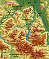 Berchtesgadener Alpen.jpg 509 × 619; 152 KB
-
 Berchtesgadener Alpen.png 3,493 × 3,413; 2.52 MB
-
 Engadey map early 19th century.JPG 662 × 514; 132 KB
-
 Felszeichnung-salzburger-hochthron.png 395 × 323; 225 KB
-
 Franzisco-Josephinische Landesaufnahme - Berchtesgadener Alpen.jpg 6,757 × 7,777; 23.74 MB
-
 Franziszeische Landesaufnahme - Berchtesgadener Alpen.jpg 13,981 × 17,321; 63.97 MB
-
 Geologische Karte des Untersberges bei Salzburg.jpg 4,984 × 6,451; 9.54 MB
-
 Hagengebirge.png 1,433 × 1,071; 1.87 MB
-
 Karte der Berchtesgadener Alpen Blatt I.jpg 5,415 × 7,392; 14.58 MB
-
 Karte der Berchtesgadener Alpen Blatt III.jpg 5,287 × 7,392; 15.57 MB
-
 Karte der Berchtesgadener Alpen Blatt IV.jpg 5,313 × 6,872; 9.8 MB
-
 Kartenausschnitt mit Königsee.jpg 2,462 × 3,706; 4.83 MB
-
 Kolkbläser Aufriß 1988.JPG 1,024 × 697; 92 KB
-
 Riesending-Schachthoehle.png 940 × 640; 120 KB
-
 Riesending-Schachthöhle.svg 940 × 670; 47 KB
-
 Salzburg - 31-48.jpg 3,426 × 4,961; 3.95 MB
-
 Schmittsche Karte von Südwestdeutschland - Berchtesgadener Alpen.jpg 7,059 × 7,170; 14.21 MB
-
 Specialkarte der Berchtesgadener Alpen Blatt II.jpg 5,236 × 6,494; 8.85 MB


