Category:Maps of Beloit, Ohio
Jump to navigation
Jump to search
Media in category "Maps of Beloit, Ohio"
The following 6 files are in this category, out of 6 total.
-
 Beloit, Mahoning County, Ohio, 1926 - DPLA - 1f87011be95f7f0d97ef3abd7755a4e1.jpeg 6,728 × 7,931; 8.91 MB
-
 Beloit, Mahoning County, Ohio, 1947 - DPLA - 456b451674efd0751b0a4304a64e1fe7 (page 1).jpeg 6,696 × 7,893; 7.44 MB
-
 Beloit, Mahoning County, Ohio, 1947 - DPLA - 456b451674efd0751b0a4304a64e1fe7 (page 2).jpeg 6,696 × 7,912; 8.01 MB
-
 Mahoning County Ohio incorporated and unincorporated areas Beloit highlighted.png 2,742 × 1,093; 476 KB
-
 Map of Mahoning County Ohio Highlighting Beloit Village.png 701 × 397; 24 KB
-
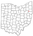 OHMap-doton-Beloit.png 274 × 300; 10 KB

.jpeg)
.jpeg)

