Category:Maps of Belize
Appearance
Countries of North America: Antigua and Barbuda · The Bahamas · Barbados · Belize · Canada · Costa Rica · Cuba · Dominica · Dominican Republic · El Salvador · Grenada · Guatemala · Haiti · Honduras · Jamaica · Mexico · Nicaragua · Panama · Saint Kitts and Nevis · Saint Lucia · Saint Vincent and the Grenadines · Trinidad and Tobago‡ · United States‡
Other territories: Anguilla · Bermuda · British Virgin Islands · Cayman Islands · Florida Keys · Greenland · Guadeloupe · Martinique · Montserrat · Puerto Rico · Saint Barthélemy · Saint-Martin · Saint Pierre and Miquelon · Turks and Caicos Islands · United States Virgin Islands
‡: partly located in North America
Wikimedia category | |||||
| Upload media | |||||
| Instance of | |||||
|---|---|---|---|---|---|
| Category combines topics | |||||
 | |||||
Subcategories
This category has the following 22 subcategories, out of 22 total.
*
A
B
- Maps of borders of Belize (28 F)
C
F
G
H
I
L
- Location maps of Belize (6 F)
M
- Maps of Cahal Pech (3 F)
- Maps of islands of Belize (55 F)
O
P
S
T
Pages in category "Maps of Belize"
The following 2 pages are in this category, out of 2 total.
Media in category "Maps of Belize"
The following 61 files are in this category, out of 61 total.
-
20240603 Fires Honduras Belize Guatemala.pdf 1,754 × 1,239; 487 KB
-
Belize - Belmopan.png 432 × 599; 42 KB
-
Belize - DPLA - 1ad6ad1821bc1fe8270c8166c80314de.jpg 2,554 × 3,278; 5.48 MB
-
Belize - DPLA - d3ee6d9f5baf4201f5e27e76f16e460a.jpg 2,552 × 3,280; 4.97 MB
-
Belize - DPLA - eab01c865d640b24dd52caf6862aa9a1.jpg 2,548 × 3,274; 5.34 MB
-
Belize Base Map.png 2,380 × 3,145; 171 KB
-
Belize blank map.svg 744 × 1,052; 91 KB
-
Belize city map 1981.jpg 1,222 × 1,720; 123 KB
-
Belize disputed w1 countrymap.svg 1,000 × 1,000; 8 KB
-
Belize districts by HDI.png 1,027 × 893; 39 KB
-
Belize DNI Solar-resource-map GlobalSolarAtlas World-Bank-Esmap-Solargis.png 1,842 × 2,605; 2.23 MB
-
Belize DNI Solar-resource-map lang-ES GlobalSolarAtlas World-Bank-Esmap-Solargis.png 1,842 × 2,605; 2.22 MB
-
Belize GHI Solar-resource-map GlobalSolarAtlas World-Bank-Esmap-Solargis.png 1,842 × 2,605; 2.25 MB
-
Belize GHI Solar-resource-map lang-ES GlobalSolarAtlas World-Bank-Esmap-Solargis.png 1,842 × 2,605; 2.24 MB
-
Belize Highways.png 725 × 1,065; 96 KB
-
Belize PVOUT Photovoltaic-power-potential-map GlobalSolarAtlas World-Bank-Esmap-Solargis.png 1,842 × 2,605; 2.24 MB
-
Belize rivers.svg 744 × 1,052; 1.06 MB
-
Belize simple map large.jpg 2,000 × 1,366; 191 KB
-
Belize2025OSM.png 2,812 × 4,352; 5.67 MB
-
BelizeMap.jpg 378 × 642; 63 KB
-
Bh-map.gif 252 × 271; 25 KB
-
Blank map of Belize.svg 788 × 1,092; 173 KB
-
Carte Monkey Bay Lodge Belize.png 411 × 578; 45 KB
-
Chinamita Territory map.png 2,356 × 1,489; 2.05 MB
-
Distribution of Mayan languages in 16th century Belize.svg 1,000 × 1,111; 34 KB
-
Distribution-myn.png 800 × 454; 12 KB
-
Dzuluinicob settlements towards the 16th century per Jones 1989.svg 270 × 300; 41 KB
-
ECDM 20160804 TC EARL.pdf 1,625 × 1,125; 760 KB
-
ECDM 20160805 TC EARL.pdf 1,625 × 1,125; 686 KB
-
ECDM 20160829 ECHO CentralAmericaMap.pdf 1,625 × 1,125; 591 KB
-
ECDM 20171006 TC-SIXTEEN.pdf 2,479 × 1,754; 1.58 MB
-
ECDM 20171009 TC-NATE.pdf 2,479 × 1,754; 1.64 MB
-
ECDM 20200603 Central-America TCs.pdf 1,625 × 1,125; 758 KB
-
ECDM 20200824 TCs LAURA MARCO.pdf 1,625 × 1,125; 602 KB
-
ECDM 20200831 TC LAURA Overview.pdf 1,625 × 1,125; 542 KB
-
ECDM 20200903 TC NANA.pdf 1,625 × 1,125; 1.87 MB
-
ECDM 20201007 TCs DELTA GAMMA.pdf 1,625 × 1,125; 641 KB
-
ECDM 20201028 TC ZETA.pdf 1,625 × 1,125; 720 KB
-
ECDM 20201105 TC ETA.pdf 1,625 × 1,125; 504 KB
-
ECDM 20201116 TC-IOTA(1).pdf 1,625 × 1,125; 635 KB
-
ECDM 20201126 TC-ETA-IOTA.pdf 1,625 × 1,125; 628 KB
-
ECDM 20221219 TC Hurricane Season.pdf 2,479 × 1,754; 662 KB
-
ECDM 20240410 Central America(1).pdf 2,479 × 1,754; 844 KB
-
ECHO Belize Editable A4 Portrait.pdf 1,239 × 1,754; 212 KB
-
ECHO Central America Editable A3 Landscape.pdf 2,100 × 1,575; 784 KB
-
ECHO Central America Editable A3 Landscape.png 1,344 × 1,008; 506 KB
-
FLII Belize.png 565 × 842; 424 KB
-
Gales Point Übersicht.png 738 × 879; 134 KB
-
Inkscape-encoding-error.png 1,157 × 886; 922 KB
-
Jones Columbian Muzul map.png 1,440 × 772; 448 KB
-
Map Shows Belizean Protected Areas Assessed for Risk (PIA25862).jpg 2,550 × 3,300; 668 KB
-
Map Shows Belizean Protected Areas Assessed for Risk (PIA25862).tif 2,550 × 3,300; 13.32 MB
-
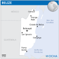
Mapa do Belize (OCHA).svg 254 × 254; 177 KB
-
PAT - Belize.gif 800 × 1,035; 191 KB
-
Population density of Belize districts.png 3,902 × 6,275; 555 KB
-
Region03.jpg 838 × 604; 461 KB
-
Shipstern CMA Map.png 1,292 × 1,353; 2.11 MB
-
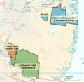
Shipstern HoneyCamp FreshwaterCreek.png 2,022 × 1,972; 4.62 MB
-
SolarGIS-Solar-map-Belize-en.png 639 × 900; 299 KB
-
Territorial Evolution of Belize.svg 888 × 711; 567 KB
-
Turneffe Nautical.jpg 549 × 831; 68 KB


