Category:Maps of Beijing under the Qing Dynasty
Jump to navigation
Jump to search
Subcategories
This category has only the following subcategory.
Media in category "Maps of Beijing under the Qing Dynasty"
The following 43 files are in this category, out of 43 total.
-
1900 French map of Beijing.jpg 8,000 × 7,167; 10.31 MB
-
1903 map of Peking by Landesaufnahme. Kartogr. Abteilung BPL 12177.png 698 × 750; 905 KB
-
Admiralty Chart No 258 Pei-Ho or Peking River - Sheet 4, Published 1863.jpg 24,233 × 16,053; 58.93 MB
-
Battle of Beijing.jpg 768 × 808; 65 KB
-
Beijing 1830-1870.jpg 6,648 × 12,261; 19.15 MB
-
Beijing 1861-1890 Inner City.jpg 16,800 × 15,600; 41.09 MB
-
Beijing 1874-1879 vicinity NW.jpg 6,186 × 3,907; 4.8 MB
-
Beijing 1886 Vicinity.jpg 11,558 × 8,495; 9.45 MB
-
Beijing 1900 Aufgenommen.jpg 7,151 × 8,606; 11.81 MB
-
Beijing 1900.jpg 6,429 × 7,811; 9.47 MB
-
Beijing 1903 Legation DE.jpg 8,555 × 5,224; 4.65 MB
-
Beijing city wall map HU.jpg 570 × 600; 110 KB
-
Beijing city wall map vectorized (fr).svg 591 × 622; 205 KB
-
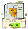
Beijing city wall map vectorized cs.svg 591 × 622; 43 KB
-
Beijing city wall map vectorized.svg 591 × 622; 275 KB
-
Beijing city wall map.jpg 591 × 622; 64 KB
-
Beijing history.jpg 903 × 715; 59 KB
-
Beijing in Ming and Qing Dynasties.jpg 948 × 743; 93 KB
-
Beijing quan tu. LOC gm71005149.jpg 7,705 × 11,733; 10.59 MB
-
Beijing-Kangxi.jpg 612 × 505; 280 KB
-
Beijings layout genom historien.jpg 748 × 591; 158 KB
-
Beijings stadsmurar fårn Mingdynastin.jpg 1,500 × 1,707; 214 KB
-
Ca. 1900 French map of Beijing by Service Geographique de l'Armee.jpg 19,520 × 17,633; 55.36 MB
-
Du Halde, map of Beijing.jpg 2,472 × 3,304; 885 KB
-
EB9 Peking 2.png 3,016 × 4,000; 3.93 MB
-
Jing cheng ge guo zan fen jie zhi quan tu. LOC 2006458552.jpg 6,429 × 7,811; 9.14 MB
-
Jing cheng ge guo zan fen jie zhi quan tu. LOC 2006458552.tif 6,429 × 7,811; 143.67 MB
-
Peking (2676791824).jpg 1,689 × 2,000; 3.42 MB
-
Peking (Mittler, 1903).tif 3,306 × 4,118; 6 MB
-
PortofTakuandPeking.jpg 742 × 1,006; 312 KB
-
The complete map of Qianlong's capital (1750) Northern Half 乾隆京城全图 『乾隆京城全図』.png 10,808 × 5,808; 90.38 MB
-
The complete map of Qianlong's capital (1750) Southern Half 乾隆京城全图 『乾隆京城全図』.png 10,808 × 5,184; 85.55 MB
-
Under marching orders - a story of Mary Porter Gamewell (1909) (14596167519).jpg 1,968 × 1,350; 310 KB
-
Yuandadu map.jpg 591 × 780; 58 KB
-
מפת בייג'ינג העתיקה.jpg 591 × 622; 158 KB
-
京师城内首善全图.清代.jpg 8,848 × 9,500; 17.21 MB
-
北京最早带经纬线的地图.Plan de Pékin.by Philippe Buache.1752年.jpg 7,110 × 7,548; 12.8 MB
-
皇城1.jpg 591 × 622; 58 KB


