Category:Maps of Bath and North East Somerset District
Jump to navigation
Jump to search
English: Maps of the Bath and North East Somerset district, in the ceremonial county of Somerset, England.
Subcategories
This category has only the following subcategory.
B
Media in category "Maps of Bath and North East Somerset District"
The following 10 files are in this category, out of 10 total.
-
 Bath and North East Somerset in England.png 2,165 × 2,670; 98 KB
-
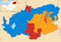 Bath and North East Somerset UK local election 1995 map.svg 1,425 × 982; 769 KB
-
 Bath and North East Somerset UK local election 2019 map.svg 1,425 × 982; 1.22 MB
-
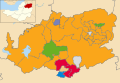 Bath and North East Somerset UK local election 2023 map.svg 1,425 × 982; 1.22 MB
-
 Bath and North East Somerset UK locator map.svg 1,425 × 901; 1.15 MB
-
 Bath and North East Somerset UK ward map 1995 (blank).svg 1,425 × 982; 769 KB
-
 Bath and North East Somerset UK ward map 2010 (blank).svg 1,425 × 982; 708 KB
-
 Bath and North East Somerset UK ward map 2019 (blank).svg 1,425 × 982; 1.22 MB
-
 BATH AND NORTH EAST SOMSERSET (49910224363).png 2,160 × 1,080; 516 KB
-
 EnglandBathAndNorthEastSomerset.png 200 × 247; 26 KB


.png)

.svg)
.svg)
.svg)