Category:Maps of Büren (Westfalen)
Jump to navigation
Jump to search
Wikimedia category | |||||
| Upload media | |||||
| Instance of | |||||
|---|---|---|---|---|---|
| Category combines topics | |||||
| Büren | |||||
municipality of Germany | |||||
| Pronunciation audio | |||||
| Instance of |
| ||||
| Location | Paderborn, Detmold Government Region, North Rhine-Westphalia, Germany | ||||
| Head of government |
| ||||
| Population |
| ||||
| Area |
| ||||
| Elevation above sea level |
| ||||
| Different from | |||||
| official website | |||||
 | |||||
Media in category "Maps of Büren (Westfalen)"
The following 17 files are in this category, out of 17 total.
-
Bahnstrecke-geseke-bueren-markiert.png 450 × 284; 67 KB
-
Büren geothermische Karte.png 865 × 683; 114 KB
-
Lage der Stadt Büren in Deutschland.png 188 × 235; 4 KB
-
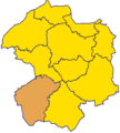
Lage Ort Büren Kreis Paderborn.png 222 × 247; 7 KB
-
North rhine w pb Büren.png 849 × 849; 408 KB
-
Ortsteile Büren - Ahden.svg 580 × 640; 143 KB
-
Ortsteile Büren - Barkhausen.svg 580 × 640; 143 KB
-
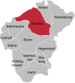
Ortsteile Büren - Brenken.svg 580 × 640; 143 KB
-
Ortsteile Büren - Eickhoff.svg 580 × 640; 143 KB
-
Ortsteile Büren - Harth.svg 580 × 640; 143 KB
-
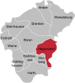
Ortsteile Büren - Hegensdorf.svg 580 × 640; 143 KB
-
Ortsteile Büren - Siddinghausen.svg 580 × 640; 143 KB
-
Ortsteile Büren - Steinhausen.svg 580 × 640; 143 KB
-
Ortsteile Büren - Weiberg.svg 580 × 640; 143 KB
-
Ortsteile Büren - Weine.svg 580 × 640; 143 KB
-
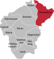
Ortsteile Büren - Wewelsburg.svg 580 × 640; 143 KB
-
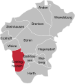
Ortsteile Büren.svg 580 × 640; 142 KB

