Category:Maps of Béjaïa
Jump to navigation
Jump to search
| NO WIKIDATA ID FOUND! Search for Maps of Béjaïa on Wikidata | |
| Upload media |
Media in category "Maps of Béjaïa"
The following 12 files are in this category, out of 12 total.
-

-
 Admiralty Chart No 165 Bougie to Malta, Published 1880.jpg 23,081 × 11,366; 41.96 MB
-
 Admiralty Chart No 1710 Algeria Bougie (Béjaïa), Published 1897.jpg 8,066 × 10,998; 11.98 MB
-
 AFR V2 D313 Bougie, Algeria.jpg 1,799 × 1,578; 400 KB
-
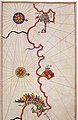 Algiers and Bejaia by Piri Reis.jpg 531 × 817; 142 KB
-
 Bugia 1570.png 120 × 210; 68 KB
-
 Bugia Labez ou Calaa.jpg 390 × 452; 56 KB
-
 Carte des environs de Béjaïa au XVIe siècle.jpg 100 × 162; 6 KB
-
 Dz - Béjaïa (Wilaya de Béjaïa) location map.svg 1,249 × 930; 399 KB
-
 DZ 06 Bejaia.svg 2,408 × 1,812; 129 KB
-
 Royaume de Bugie aux XVIIᵉ siècle.png 394 × 383; 285 KB
-
 Schéma urbain béjaïa.png 424 × 580; 90 KB
.jpg)

,_Published_1897.jpg)


_location_map.svg)


