Category:Maps of Béarn
Jump to navigation
Jump to search
Media in category "Maps of Béarn"
The following 34 files are in this category, out of 34 total.
-

-
 Aire linguistique béarnais.png 1,828 × 1,756; 480 KB
-
 Archidiaconé de Soubestre (selon P. Raymond).jpg 3,507 × 2,480; 2.36 MB
-
 Bearn in France (1789).svg 2,000 × 1,922; 1.05 MB
-
 Béarn Antique.png 1,819 × 1,652; 653 KB
-
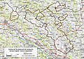
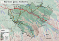 Béarn des gaves Soubestre 2018-03-11.svg 1,052 × 744; 9.22 MB
-
 Béarn Moyen Age.png 1,804 × 1,645; 738 KB
-
 Béarn.jpg 1,465 × 1,050; 846 KB
-
 Canton d'Artix et Pays de Soubestre.jpg 3,507 × 2,480; 2.16 MB
-
 Carte Béarn 1663.jpg 3,451 × 4,851; 1.99 MB
-

-
 Carte Junker.jpg 2,846 × 2,808; 1.01 MB
-
 Carte Patrimoine Lescar.png 993 × 552; 688 KB
-
 CC Canton d Arzacq.jpg 3,507 × 2,480; 1.93 MB
-
 Densité du Béarn.png 1,836 × 1,828; 662 KB
-
 Diffusion Béarnaise.png 1,878 × 1,805; 660 KB
-
 Formation Béarn.png 2,027 × 1,552; 651 KB
-
 Gascony and Béarn.png 800 × 509; 118 KB
-
 Intercommunalités du Béarn 2018.png 1,836 × 1,600; 584 KB
-
 Intercommunalités du Béarn.png 1,836 × 1,600; 592 KB
-
 Le pais de Bearn - CBT 5880057.jpg 5,508 × 4,335; 6.71 MB
-
 Lescar Limite Communale.jpg 1,275 × 793; 344 KB
-
 Origine Béarn.png 1,783 × 1,607; 663 KB
-
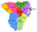
 Parçans deu Bearn.jpg 2,480 × 2,837; 1.44 MB
-
 Pont Long (Béarn Pau).svg 1,052 × 744; 9.21 MB
-
 Position Ossau.png 820 × 579; 716 KB
-
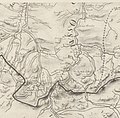
 Principatus Benearnia. La principauté de Béarn - btv1b5973007d.jpg 3,451 × 4,851; 1.94 MB
-
 Régions historiques du Béarn.png 1,727 × 1,610; 735 KB
-
 Soubestre (traditionnel).svg 1,052 × 744; 7.16 MB
-
 Système défensif Béarn Fébus.png 1,892 × 1,656; 295 KB
-
 Territoires Fébus Début de Règne.png 3,422 × 2,710; 1.88 MB
-
 Territoires Fébus Mort.png 3,422 × 2,710; 1.91 MB
-
 ZNIEFF Lescar.png 921 × 722; 657 KB
-
 Zonage Lescar.png 725 × 715; 503 KB
.jpg)

.jpg)
.svg)


.svg)


.svg)


