Category:Maps of Avratyn, Khmelnytskyi Oblast
Jump to navigation
Jump to search
Media in category "Maps of Avratyn, Khmelnytskyi Oblast"
The following 5 files are in this category, out of 5 total.
-
 Карта Волинької губерніїт1850 року..png 491 × 324; 334 KB
-
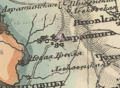 Карта Західної частини Росії картографа Шуберта 1826-1840 років.png 421 × 309; 273 KB
-

-
 Карта Російської імперії 1812 року для Наполеона..png 455 × 271; 202 KB
-
 Частина карти західної України Фрідріха фон Міга 1779 -1783 рр..png 495 × 336; 119 KB


