Category:Maps of Australian Electoral Divisions, 2010
Jump to navigation
Jump to search
Subcategories
This category has the following 7 subcategories, out of 7 total.
Media in category "Maps of Australian Electoral Divisions, 2010"
The following 17 files are in this category, out of 17 total.
-
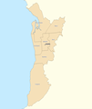
Adelaide divisions overview 2010.png 900 × 1,065; 127 KB
-
Australian Capital Territory divisions overview 2010.png 600 × 710; 23 KB
-
Brisbane divisions overview 2010.png 900 × 1,065; 198 KB
-
Melbourne divisions overview 2010.png 900 × 1,065; 191 KB
-
Northern Territory divisions overview 2010.png 900 × 1,065; 144 KB
-
Outside Brisbane divisions overview 2010.png 900 × 1,065; 179 KB
-
Outside Melbourne divisions overview 2010.png 900 × 1,065; 164 KB
-
Outside Perth divisions overview 2010.png 900 × 1,065; 119 KB
-
Outside Sydney divisions overview 2010.png 900 × 1,065; 178 KB
-
Perth divisions overview 2010.png 900 × 1,065; 143 KB
-
Rest of New South Wales divisions overview 2010.png 900 × 1,065; 184 KB
-
Rest of Queensland divisions overview 2010.png 900 × 1,065; 156 KB
-
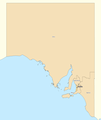
Rest of South Australia divisions overview 2010.png 900 × 1,065; 115 KB
-
Rest of Victoria divisions overview 2010.png 900 × 825; 134 KB
-
Rest of Western Australia divisions overview 2010.png 900 × 1,065; 132 KB
-
Sydney divisions overview 2010.png 900 × 1,065; 248 KB
-
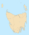
Tasmania divisions overview 2010.png 900 × 1,065; 180 KB


