Category:Maps of Auriac-Lagast
Jump to navigation
Jump to search
Wikimedia category | |||||
| Upload media | |||||
| Instance of | |||||
|---|---|---|---|---|---|
| Category combines topics | |||||
| Auriac-Lagast | |||||
commune in Aveyron, France  .svg)  | |||||
| Instance of | |||||
| Location |
| ||||
| Street address |
| ||||
| Population |
| ||||
| Area |
| ||||
| Elevation above sea level |
| ||||
 | |||||
Subcategories
This category has only the following subcategory.
Media in category "Maps of Auriac-Lagast"
The following 9 files are in this category, out of 9 total.
-
 12015-Auriac-Lagast-Arron.png 3,057 × 2,480; 1.23 MB
-
 12015-Auriac-Lagast-cadastre.svg 961 × 744; 4.34 MB
-
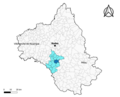 12015-Auriac-Lagast-Canton.png 3,057 × 2,480; 1.26 MB
-
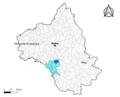 12015-Auriac-Lagast-EPCI.png 3,057 × 2,480; 1.25 MB
-
 12015-Auriac-Lagast-Sols.png 3,507 × 2,480; 1.95 MB
-
 12015-Auriac-Lagast-ZNIEFF1.png 3,519 × 2,480; 1.43 MB
-
 12015-Auriac-Lagast-ZNIEFF1.svg 1,056 × 744; 5.96 MB
-
 12015-Auriac-Lagast-ZNIEFF2.png 3,519 × 2,480; 1.39 MB
-
 Map commune FR insee code 12015.png 756 × 605; 40 KB


