Category:Maps of Augsburg by Braun & Hogenberg
Jump to navigation
Jump to search
Media in category "Maps of Augsburg by Braun & Hogenberg"
The following 14 files are in this category, out of 14 total.
-
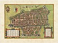
 Augsburg Stadtansicht von Osten Rogel Hans.jpeg 2,048 × 1,539; 987 KB
-
 Wolf-Dietrich-Klebeband Städtebilder G 079 III.jpg 2,000 × 1,547; 1.59 MB
-
 Braun Augsburg HAAB.jpg 1,280 × 909; 617 KB
-
 Braun Augsburg UBHD.jpg 2,076 × 1,490; 2.23 MB
-
 Augsburg 1549.jpg 1,024 × 768; 388 KB
-
 Augusta juxta figuram quam hisce temporibus habet delineata - btv1b531788979 (1 of 2).jpg 6,578 × 4,958; 5.18 MB
-
 Augusta juxta figuram quam hisce temporibus habet delineata - btv1b550048238.jpg 5,861 × 4,164; 3.83 MB
-
 Beschreibung der Städt der Welt - Braun & Hogenberg - btv1b52512111k (128 of 378).jpg 8,231 × 6,347; 8.55 MB
-

-

-
 Frans Hogenberg, Augusta Vindelicorum (FL43896115 3941858).jpg 13,866 × 9,912; 197.34 MB
-
 Historischer Plan von Augsburg.jpg 3,845 × 2,623; 1.75 MB
-
 Stadtplan Augsburg von 1572.jpg 13,300 × 9,804; 63.53 MB
-
 Civitates orbis terrarvm, liber primvs 1577 (107274854).jpg 15,790 × 10,924; 27.2 MB


.jpg)

.jpg)


.jpg)


.jpg)