<nowiki>Category:Maps of Aubagne; categoría de Wikimedia; 维基媒体分类; विकिपीडिया:श्रेणी; Wikimedia-categorie; категорияд Ангилал; kategória projektov Wikimedia; categorie în cadrul unui proiect Wikimedia; tudalen categori Wikimedia; kategori Wikimedia; categoría de Wikimedia; Wikimedia:Kategorija; kategori e Wikimedias; Wikimedia category; Wikimedia:Klassys; категория на Уикимедия; jamii ya Wikimedia; Vikimedya kategorisi; ویکیمیڈیا زمرہ; หน้าหมวดหมู่วิกิมีเดีย; Wikimedia-Kategorie; Wikimedia-kategori; categurìa 'e nu pruggette Wikimedia; категорія проєкту Вікімедіа; kawan Wikimèdia; гурӯҳи Викимедиа; 维基媒体分类; Wikimedia-Kategorie; 위키미디어 분류; Wikimedia-bólkur; kategorio en Vikimedio; Викимедиина категорија; Wikimedia-Kategorie; Wikimedia:Ronnaghys; উইকিমিডিয়া বিষয়শ্রেণী; page de catégorie de Wikimedia; kategori Wikimedia; kategorija na Wikimediji; kategorya ng Wikimedia; 维基媒体分类; категория в проекте Викимедиа; pajenn rummata eus Wikimedia; विकिपीडिया वर्ग; kategorija w projektach Wikimedije; thể loại Wikimedia; катэгорыя ў праекце Вікімедыя; Wikimedia projekta kategorija; kategoria ti Wikimedia; категорија на Викимедији; kategorija na Wikimediji; Վիքիմեդիայի նախագծի կատեգորիա; categoria de um projeto da Wikimedia; Wikimedia category; Wikimedia-Kategorie; Wikimedia-kategori; Wikimedia-kategori; kategori Wikimédia; kategori Wikimedia; Wikimedia-kategori; विकिमिडिया श्रेणी; پۆلی ویکیمیدیا; Wikimedia category; تصنيف ويكيميديا; Vikimédia ñemohenda; 維基媒體分類; Wikimedia:ကဏ္ဍခွဲခြင်း; 維基媒體分類; Wikimédia-kategória; વિકિપીડિયા શ્રેણી; categoria Vicimediorum; Wikimediako kategoria; Wikimedia-categorie; categoría de Wikimedia; categoria de Wikimedia; Wikimedia-Kategorie; Wikimedia-Kategorie; 维基媒体分类; Viciméid catagóir; ردهٔ ویکیپدیا; Wikimedia-kategorie; Wîkîmediya:Kategorî; ვიკიპედია:კატეგორიზაცია; ウィキメディアのカテゴリ; categoria Wikimedia; Викимедиа категорияһы; تصنيف بتاع ويكيميديا; катэгорыя ў праекце Вікімэдыя; විකිමීඩියා ප්රභේද පිටුව; Викимедиа проектындагы төркем; kategori Wikimedia; Vikipidiya:Shopni; Wikimedia-kategorie; Wikimedia-luokka; гурӯҳ дар лоиҳаи Викимедиа; Wikimedia category; विकिमिडिया श्रेणी; விக்கிமீடியப் பகுப்பு; categoria di un progetto Wikimedia; gurühi Vikimedia; د ويکيمېډيا وېشنيزه; Wikimedia-categorie; Wikimedia kategooria; Wikimedia-kategoriija; Викимедиа проектындагы төркем; विकिमीडिया श्रेणी; דף קטגוריה; ẹ̀ka Wikimedia; catigurìa di nu pruggettu Wikimedia; categoria de um projeto da Wikimedia; 维基媒体分类; Kategoriya ning Wikimedia; tumbung Wikimedia; Wikimedia-Kategorie; kategorija Wikimedie; Wikimedia proyektındağı törkem; 維基媒體分類; Wikimedia категориясы; kategori Wikimedia; kategoria w projekcie Wikimedia; വിക്കിമീഡിയ വർഗ്ഗം; 維基媒體分類; kategori Wikimedia; Wikimedia-kategory; زمرو:وڪيپيڊيا زمرا بندي; Wikimedia-Kategorie; categoría de Wikimedia; kategorie na projektech Wikimedia; κατηγορία εγχειρημάτων Wikimedia; 維基媒體分類</nowiki>
Subcategories
This category has only the following subcategory.


.svg)


 13005-Aubagne-Hydro.jpeg 5,846 × 4,133; 3.63 MB
 13005-Aubagne-Sols.png 3,270 × 2,598; 5.33 MB
 Aubagne OSM 01.png 364 × 439; 113 KB
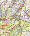 Aubagne OSM 02.png 364 × 439; 218 KB
 Carte d'Aubagne XVIIIéme siècle.jpg 958 × 718; 189 KB
 Carte d'Aubagne-en-Provence au XVIIIe siècle.jpg 800 × 600; 135 KB
 Map commune FR insee code 13005.png 756 × 605; 90 KB
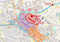 Plan 3e extension Aubagne.png 1,213 × 853; 784 KB
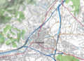 Plan Aubagne 2.png 862 × 623; 1.13 MB
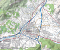 Plan Aubagne.png 983 × 822; 1.75 MB
 Plan centre Aubagne.png 1,180 × 789; 704 KB
 Plan ferroviaire Aubagne.png 967 × 757; 283 KB
 Plan routier Aubagne.png 1,155 × 810; 1.34 MB
 Plan topographique de la ville de Marseille Matheron Philippe 1830.jpg 1,313 × 1,054; 351 KB
 Plan ville basse Aubagne.png 1,213 × 853; 779 KB
 Plan ville haute Aubagne.png 1,213 × 853; 774 KB
 Topographie Aubagne.png 1,243 × 830; 1.39 MB
 Tracé du Val'tram d'Aubagne.jpg 765 × 1,847; 114 KB

.jpg)


