Category:Maps of Ashfield District
Jump to navigation
Jump to search
Media in category "Maps of Ashfield District"
The following 11 files are in this category, out of 11 total.
-
 ASHFIELD (49911039762).png 2,160 × 1,080; 370 KB
-
 Ashfield UK local election 2003 map.svg 1,011 × 1,305; 299 KB
-
 Ashfield UK local election 2007 map.svg 1,011 × 1,305; 299 KB
-
 Ashfield UK local election 2011 map.svg 1,011 × 1,305; 298 KB
-
 Ashfield UK locator map.svg 1,030 × 1,305; 906 KB
-
 Ashfield UK ward map 2010 (blank).svg 1,011 × 1,305; 297 KB
-
 Ashfield UK ward map 2015 (blank).svg 1,011 × 1,305; 383 KB
-
 AshfieldINNottinghamshire.svg 354 × 623; 29 KB
-
 Hucknall unparished area UK locator map.svg 1,011 × 1,305; 243 KB
-
 Kirkby in Ashfield and Sutton in Ashfield unparished area UK locator map.svg 1,011 × 1,305; 243 KB
-
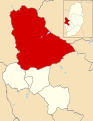
 NottinghamshireAshfield.png 200 × 347; 20 KB
.png)


.svg)
.svg)