Category:Maps of Arkel
Jump to navigation
Jump to search
Wikimedia category | |||||
| Upload media | |||||
| Instance of | |||||
|---|---|---|---|---|---|
| Category combines topics |
| ||||
| Arkel | |||||
 | |||||
| Instance of |
| ||||
| Location |
| ||||
| Capital | |||||
| Dissolved, abolished or demolished date |
| ||||
| Population |
| ||||
| Replaced by | |||||
| |||||
Media in category "Maps of Arkel"
The following 3 files are in this category, out of 3 total.
-
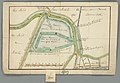
 Arkel, Gemeenteatlas van Nederland.jpg 2,652 × 2,099; 1.21 MB
-
 Het land van Arkel beneeden den Bazel ofte Zouwen Dijk (5095696927).jpg 1,024 × 706; 171 KB
-
 Map NL - Giessenlanden - Arkel.png 800 × 600; 13 KB

.jpg)
