Category:Maps of Apulia
Jump to navigation
Jump to search
- Regions of Italy: Abruzzo · Aosta Valley · Apulia · Basilicata · Calabria · Campania · Emilia-Romagna · Friuli-Venezia Giulia · Lazio · Liguria · Lombardy · Marche · Molise · Piedmont · Sardinia · Sicily · Trentino-South Tyrol · Tuscany · Umbria · Veneto
Wikimedia category | |||||
| Upload media | |||||
| Instance of | |||||
|---|---|---|---|---|---|
| Category combines topics | |||||
| Apulia | |||||
region of Italy | |||||
| Instance of | |||||
| Part of | |||||
| Named after |
| ||||
| Patron saint | |||||
| Location | Italy | ||||
| Capital | |||||
| Legislative body |
| ||||
| Executive body |
| ||||
| Head of government |
| ||||
| Population |
| ||||
| Area |
| ||||
| Different from | |||||
| official website | |||||
 | |||||
Use the appropriate category for maps showing all or a large part of Apulia. See subcategories for smaller areas:
| If the map shows | Category to use |
|---|---|
| Apulia on a recently created map | Category:Maps of Apulia or its subcategories |
| Apulia on a map created more than 70 years ago | Category:Old maps of Apulia or its subcategories |
| the history of Apulia on a recently created map | Category:Maps of the history of Apulia or its subcategories |
| the history of Apulia on a map created more than 70 years ago | Category:Old maps of the history of Apulia or its subcategories |
Subcategories
This category has the following 16 subcategories, out of 16 total.
A
C
E
H
L
- Linguistic maps of Apulia (16 F)
- Location maps of Apulia (7 F)
M
- Maps of Laterza (5 F)
O
R
S
- Maps of Salento (9 F)
- SVG maps of Apulia (11 F)
T
Media in category "Maps of Apulia"
The following 69 files are in this category, out of 69 total.
-
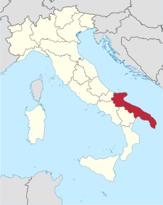
Italy Regions Apulia Map.png 220 × 257; 18 KB
-
ItalyPuglia.png 269 × 314; 9 KB
-
Admiralty Chart No 1632 Brindisi to Bari, Published 1964.jpg 17,089 × 11,330; 36.45 MB
-
Amp mappa porto cesareo.png 949 × 712; 223 KB
-
Appia dei vini.jpg 514 × 304; 14 KB
-
Apulia in Italy.svg 1,034 × 1,299; 1.67 MB
-
AqP planimetry.jpg 2,773 × 2,172; 915 KB
-
ARCIDIOCESI.GIF 681 × 602; 22 KB
-
Bari in Italy.svg 1,034 × 1,299; 3 MB
-
Bari posizione.png 350 × 424; 11 KB
-
Barletta Andria Trani posizione.png 350 × 424; 11 KB
-
Barletta-Andria-Trani in Italy.svg 1,034 × 1,299; 3 MB
-
Bisceglie urbanization.png 1,455 × 898; 2.38 MB
-
Bisceglie Urbanization.png 1,455 × 898; 2.37 MB
-
Bozza mappa territorio di Castellaneta.jpg 250 × 440; 21 KB
-
Brindisi in Italy.svg 1,034 × 1,299; 3 MB
-
Brindisi posizione.png 350 × 424; 11 KB
-
Canosacartina.png 700 × 452; 325 KB
-
Cartina della Contea di Conversano.png 1,024 × 606; 155 KB
-
Circoscrizione Puglia (Camera dei Deputati).png 1,632 × 2,112; 122 KB
-
Confini della Puglia-var.png 890 × 699; 508 KB
-
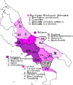
Dialetti italiani meridionali estremi 2.svg 1,150 × 1,227; 221 KB
-
Dialetti italiani meridionali estremi.jpg 510 × 362; 89 KB
-
Dialetti italiani meridionali estremi.svg 612 × 609; 530 KB
-
Faetar.png 1,161 × 918; 700 KB
-
Ferrovie salento.jpg 668 × 834; 97 KB
-
Giano 2.png 548 × 269; 18 KB
-
Isole di Soleto.jpg 842 × 595; 121 KB
-
Kaart Italie Brindisi.png 329 × 353; 19 KB
-
Kaart Italie Tarente.png 329 × 353; 19 KB
-
Lage von Alberobello.png 300 × 350; 19 KB
-
Lecce in Italy.svg 1,034 × 1,299; 3 MB
-
Lecce posizione.png 350 × 424; 11 KB
-
Locazione della città di veglie in italia.jpg 589 × 696; 106 KB
-
Magna Grecia 280aC.jpg 400 × 613; 233 KB
-
Map Cultural heritage and environment V 1992 - Touring Club Italiano CART-TEM-116.jpg 5,000 × 3,452; 11.12 MB
-
Map of region of Apulia, Italy, with provinces-ar.svg 4,170 × 3,287; 84 KB
-
Map of region of Apulia, Italy, with provinces-de.svg 4,170 × 3,287; 84 KB
-
Map of region of Apulia, Italy, with provinces-el.svg 4,170 × 3,287; 84 KB
-
Map of region of Apulia, Italy, with provinces-es.svg 4,170 × 3,287; 84 KB
-
Map of region of Apulia, Italy, with provinces-fr.svg 4,170 × 3,287; 84 KB
-
Map of region of Apulia, Italy.svg 4,170 × 3,287; 47 KB
-
Mappa Isola di Sant'Andrea (Gallipoli).png 616 × 616; 11 KB
-
Maps Puglia Iapygia.png 3,494 × 2,424; 4.29 MB
-
Margherita di Savoia Saltworks 690V7062 - Flickr - Lip Kee.jpg 800 × 640; 108 KB
-
Moldaunia.jpg 250 × 203; 53 KB
-
Molise-daunia.jpg 1,564 × 837; 75 KB
-
Monete-salentine.JPG 461 × 600; 40 KB
-
Mura monopoli.jpg 3,507 × 2,550; 882 KB
-
Neapolitan language.jpg 441 × 514; 132 KB
-
Neapolitan languages-it.svg 441 × 514; 180 KB
-
Neapolitan languages.svg 441 × 514; 60 KB
-
Ofanto.jpg 451 × 306; 132 KB
-
Ordinary statute regions of Italy.svg 735 × 867; 74 KB
-
Peucezia nel III secolo a C.png 1,047 × 692; 133 KB
-
Povincia di Foggia.gif 200 × 200; 8 KB
-
Regione thumb Puglia.svg 325 × 260; 146 KB
-
Salento - Terra d'Arneo.jpg 643 × 465; 112 KB
-
Salento - Valle della cupa.jpg 643 × 465; 101 KB
-
Salento - Valle della Cupa.jpg 643 × 465; 116 KB
-
Salentomap.svg 614 × 577; 2.34 MB
-
Taranto in Italy.svg 1,034 × 1,299; 3 MB
-
Taranto mappa.png 1,985 × 1,247; 436 KB
-
Taranto posizione.png 350 × 424; 14 KB
-
Territori pugliesi.JPG 800 × 542; 48 KB
-
Territoriosalentocarovigno.PNG 307 × 223; 105 KB
-
Tratturo-Celano-Foggia.jpg 340 × 255; 24 KB
-
Tratturo-LAquila-Foggia.jpg 340 × 255; 24 KB
-
Tratturo-Lucera-Castel di Sangro.jpg 340 × 255; 24 KB


