Category:Maps of Antigua
Jump to navigation
Jump to search
Media in category "Maps of Antigua"
The following 20 files are in this category, out of 20 total.
-
 Antigua location map.svg 437 × 328; 161 KB
-
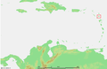 Caribbean - Antigua.PNG 929 × 606; 48 KB
-
 Antigua Enumeration District Map.svg 512 × 401; 684 KB
-
 Antigua map.jpg 1,949 × 1,354; 1.14 MB
-
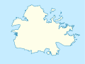
 Antigua map.svg 364 × 300; 141 KB
-
 Antigua parishes blank.png 2,000 × 1,481; 25 KB
-
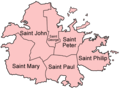 Antigua parishes english.png 500 × 370; 17 KB
-
 Antigua parishes Macedonian.png 500 × 370; 43 KB
-
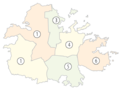 Antigua parishes numbered (color).png 565 × 424; 55 KB
-
 Antigua parishes numbered.png 200 × 148; 5 KB
-
 Antigua-Saint George.png 100 × 74; 3 KB
-
 Antigua-Saint John.png 100 × 74; 3 KB
-
 Antigua-Saint Mary.png 100 × 74; 3 KB
-
 Antigua-Saint Paul.png 100 × 74; 3 KB
-
 Antigua-Saint Peter.png 100 × 74; 3 KB
-
 Antigua-Saint Philip.png 100 × 74; 3 KB
-
 Antigua2021OSM.png 6,608 × 4,737; 9.54 MB
-
 Enumeration districts of Antigua (grey).svg 512 × 401; 738 KB
-
 Major Division of North Coast.png 367 × 284; 50 KB
-
 MapAntigua.jpg 657 × 528; 174 KB


.png)


.svg)

