<nowiki>Category:Maps of Antibes; विकिमिडिया श्रेणी; kategori Wikimedia; Wikimedia category; د ويکيمېډيا وېشنيزه; Vikimedya kategorisi; ویکیمیڈیا زمرہ; kategória projektov Wikimedia; категорія проєкту Вікімедіа; 维基媒体分类; Wikimedia-Kategorie; Викимедиина категорија; Wikimedia-Kategorie; विकिपीडिया:श्रेणी; page de catégorie de Wikimedia; kategorija na Wikimediji; विकिपीडिया वर्ग; категорија на Викимедији; Wikimedia-Kategorie; Wikimedia-kategori; kategori Wikimédia; تصنيف ويكيميديا; pajenn rummata eus Wikimedia; Wikimedia:ကဏ္ဍခွဲခြင်း; 維基媒體分類; Wikimedia категориясы; categoría de Wikimedia; Wikimedia-categorie; Wikimedia-Kategorie; tudalen categori Wikimedia; Viciméid catagóir; Վիքիմեդիայի նախագծի կատեգորիա; 维基媒体分类; Wikimedia-kategori; ვიკიპედია:კატეგორიზაცია; ウィキメディアのカテゴリ; categoria Wikimedia; تصنيف بتاع ويكيميديا; විකිමීඩියා ප්රභේද පිටුව; categoria Vicimediorum; विकिमीडिया वर्गः; विकिमीडिया श्रेणी; Wikimedia-luokka; Wikimedia category; gurühi Vikimedia; катэгорыя ў праекце Вікімэдыя; Викимедиа проектындагы төркем; catigurìa di nu pruggettu Wikimedia; หน้าหมวดหมู่วิกิมีเดีย; Wikimedia:Kategorija; Wikimedia-Kategorie; Wikimedia:Klassys; категория на Уикимедия; categorie în cadrul unui proiect Wikimedia; categurìa 'e nu pruggette Wikimedia; Wikimedia-kategori; kawan Wikimèdia; 維基媒體分類; 위키미디어 분류; Wikimedia-bólkur; kategorio en Vikimedio; kategori Wikimedia; Wikimedia:Ronnaghys; উইকিমিডিয়া বিষয়শ্রেণী; kategori Wikimedia; 维基媒体分类; kategorija w projektach Wikimedije; thể loại Wikimedia; Wikimedia projekta kategorija; Wikimedia-kategorie; categoria de um projeto da Wikimedia; Wikimedia category; категорияд Ангилал; Wikimedia-kategori; kategori Wikimedia; پۆلی ویکیمیدیا; Wikimedia category; Vikimédia ñemohenda; Wikimédia-kategória; વિકિપીડિયા શ્રેણી; Wikimediako kategoria; категория в проекте Викимедиа; Wikimedia-Kategorie; катэгорыя ў праекце Вікімедыя; Wikimedia-kategorie; Wîkîmediya:Kategorî; विकिमिडिया श्रेणी; Wikimedia-Kategorie; דף קטגוריה; Викимедиа проектындагы төркем; kategorie na projektech Wikimedia; categoría de Wikimedia; κατηγορία εγχειρημάτων Wikimedia; Wikimedia-kategoriija; гурӯҳ дар лоиҳаи Викимедиа; Wikimedia-kategory; categoría de Wikimedia; Wikimedia-Kategorie; categoria di un progetto Wikimedia; Wikimedia-categorie; jamii ya Wikimedia; Kategoriya ning Wikimedia; 維基媒體分類; 維基媒體分類; Викимедиа категорияһы; categoria de Wikimedia; kategorya ng Wikimedia; ẹ̀ka Wikimedia; гурӯҳи Викимедиа; categoria de um projeto da Wikimedia; kategorija na Wikimediji; kategori e Wikimedias; tumbung Wikimedia; kategoria ti Wikimedia; kategorija Wikimedie; Wikimedia proyektındağı törkem; Wikimedia-categorie; 维基媒体分类; kategori Wikimedia; kategoria w projekcie Wikimedia; വിക്കിമീഡിയ വർഗ്ഗം; 維基媒體分類; kategori Wikimedia; Vikipidiya:Shopni; زمرو:وڪيپيڊيا زمرا بندي; ردهٔ ویکیپدیا; categoría de Wikimedia; Wikimedia kategooria; 维基媒体分类; விக்கிமீடியப் பகுப்பு</nowiki>
Subcategories
This category has the following 2 subcategories, out of 2 total.


 "Plan de la Rade du Gourjan et des Isles Ste. Marguerite" (22255196441).jpg 3,267 × 2,429; 1.69 MB
 "Plan de la Ville et Port d'Antibe" (22056669970).jpg 3,267 × 2,429; 1.79 MB
 06004-Antibes-Hydro.jpeg 5,846 × 4,133; 2.44 MB
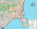 06004-Antibes-Sols.png 3,270 × 2,598; 5.21 MB
 Admiralty Chart No 2822 Gulfs of Napoule and Juan including Cannes and Antibes, Published 1905.jpg 12,224 × 8,208; 15.95 MB
 Antibes quartiers2.png 794 × 1,123; 205 KB
 Antibes vieille Ville.png 768 × 685; 290 KB
 Antibes Zeiller 15792.jpg 2,398 × 1,804; 2.54 MB
 Carte vieille ville antibes.jpg 1,152 × 1,007; 697 KB
 Fotothek df tg 0001874 Architektur ^ Festungsbau.jpg 800 × 497; 169 KB
 France militaire 1836 TIII 157024.jpg 2,960 × 2,211; 1.15 MB

 Map commune FR insee code 06004.png 756 × 605; 75 KB
 Plan d'Antibes 1785.jpg 1,767 × 1,259; 484 KB
 Plans des ports de France (1777) - Antibes.jpg 6,308 × 4,560; 3.89 MB
.jpg)
.jpg)


.png)


_-_Antibes.jpg)