Category:Maps of Anlhiac (Dordogne)
Jump to navigation
Jump to search
Subcategories
This category has the following 4 subcategories, out of 4 total.
R
- Road maps of Anlhiac (2 F)
Media in category "Maps of Anlhiac (Dordogne)"
The following 3 files are in this category, out of 3 total.
-
 24009-Anlhiac-argile.jpg 3,057 × 2,480; 767 KB
-
 24009-Anlhiac-Sols.png 3,270 × 2,598; 2.4 MB
-
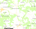 Map commune FR insee code 24009.png 756 × 605; 51 KB


