Category:Maps of Angoustrine-Villeneuve-des-Escaldes
Jump to navigation
Jump to search
Wikimedia category | |||||
| Upload media | |||||
| Instance of | |||||
|---|---|---|---|---|---|
| Category combines topics | |||||
| Angoustrine-Villeneuve-des-Escaldes | |||||
commune in Pyrénées-Orientales, France .jpg) Vista general de la vila  | |||||
| Pronunciation audio | |||||
| Instance of | |||||
| Location | |||||
| Located in or next to body of water | |||||
| Head of government |
| ||||
| Population |
| ||||
| Area |
| ||||
| Elevation above sea level |
| ||||
| official website | |||||
 | |||||
Media in category "Maps of Angoustrine-Villeneuve-des-Escaldes"
The following 18 files are in this category, out of 18 total.
-
 66005 in dept66.svg 1,000 × 547; 83 KB
-
 66005-Angoustrine-Villeneuve-des-Escaldes-argile.png 4,076 × 3,307; 8.64 MB
-
 66005-Angoustrine-Villeneuve-des-Escaldes-Natura2000.png 5,846 × 4,133; 14.8 MB
-
 66005-Angoustrine-Villeneuve-des-Escaldes-Routes-Hydro.png 3,507 × 2,480; 1.87 MB
-
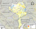
 66005-Angoustrine-Villeneuve-des-Escaldes-Sols.png 3,270 × 2,598; 2.49 MB
-
 66005-Angoustrine-Villeneuve-des-Escaldes-ZNIEFF1.png 3,057 × 2,480; 8.82 MB
-
 66005-Angoustrine-Villeneuve-des-Escaldes-ZNIEFF2.png 3,519 × 2,480; 9.29 MB
-
 66005-Angoustrine-Villeneuve-des-Escaldes-Zone inondable.png 4,677 × 3,307; 11.22 MB
-
 Angostrina el 1812.png 308 × 629; 353 KB
-
 Angostrina i Vilanova de les Escaldes a l'Alta Cerdanya.png 120 × 103; 6 KB
-
 Cal Coix el 1812.png 204 × 258; 83 KB
-
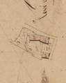
 El Mas d'en Gaula el 1812.png 479 × 544; 403 KB
-
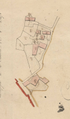
 La Part Petita el 1812.png 431 × 669; 475 KB
-
 Les Escaldes el 1812.png 224 × 245; 88 KB
-

-
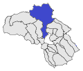
 Map commune FR insee code 66005.png 756 × 605; 119 KB
-
 Vilanova 1 el 1812.png 124 × 211; 40 KB
-
 Vilanova 2 el 1812.png 281 × 314; 146 KB


