Category:Maps of Anglars-Saint-Félix
Jump to navigation
Jump to search
Wikimedia category | |||||
| Upload media | |||||
| Instance of | |||||
|---|---|---|---|---|---|
| Category combines topics | |||||
| Anglars-Saint-Félix | |||||
commune in Aveyron, France   | |||||
| Instance of | |||||
| Location |
| ||||
| Street address |
| ||||
| Population |
| ||||
| Area |
| ||||
| Elevation above sea level |
| ||||
| official website | |||||
 | |||||
Subcategories
This category has only the following subcategory.
Media in category "Maps of Anglars-Saint-Félix"
The following 10 files are in this category, out of 10 total.
-
 12008-Anglars-Saint-Félix-Arron.png 3,057 × 2,480; 1.26 MB
-
 12008-Anglars-Saint-Félix-cadastre.svg 961 × 744; 4.84 MB
-
 12008-Anglars-Saint-Félix-Canton.png 3,057 × 2,480; 1.25 MB
-
 12008-Anglars-Saint-Félix-EPCI.png 3,057 × 2,480; 1.25 MB
-
 12008-Anglars-Saint-Félix-Natura2000.png 7,039 × 4,960; 4.59 MB
-
 12008-Anglars-Saint-Félix-Sols.png 3,507 × 2,480; 2.57 MB
-
 12008-Anglars-Saint-Félix-ZNIEFF1.png 3,519 × 2,480; 1.93 MB
-
 12008-Anglars-Saint-Félix-ZNIEFF1.svg 1,056 × 744; 8.75 MB
-
 12008-Anglars-Saint-Félix-ZNIEFF2.png 3,519 × 2,480; 1.88 MB
-
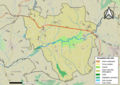
 Map commune FR insee code 12008.png 756 × 605; 32 KB


