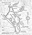
Category:Maps of Andros Island
Jump to navigation
Jump to search
English: Not to be confused with Category:Maps of Andros (Greece)
Media in category "Maps of Andros Island"
The following 8 files are in this category, out of 8 total.
-
1929 Bahamas hurricane Andros Island map.JPG 1,768 × 1,932; 652 KB
-
Andros.jpg 1,209 × 1,888; 874 KB
-
Andros2022OSM.png 3,626 × 5,884; 5.26 MB
-
AndrosIsland 15ft 4p572m shaded.png 1,138 × 1,974; 1.06 MB
-
District of Central Andros.png 161 × 239; 3 KB
-
District of North Andros.png 161 × 239; 3 KB
-
District of South Andros.png 161 × 239; 3 KB
-
Districts of Mangrove Cay.png 161 × 239; 3 KB


