Category:Maps of Albi
Jump to navigation
Jump to search
Wikimedia category | |||||
| Upload media | |||||
| Instance of | |||||
|---|---|---|---|---|---|
| Category combines topics | |||||
| Albi | |||||
French commune in Tarn, Occitania | |||||
| Instance of | |||||
| Location | |||||
| Located in or next to body of water | |||||
| Visitor center | |||||
| Head of government |
| ||||
| Population |
| ||||
| Area |
| ||||
| Elevation above sea level |
| ||||
| official website | |||||
 | |||||
Subcategories
This category has the following 3 subcategories, out of 3 total.
E
- Ecological maps of Albi (3 F)
O
- Old maps of Albi (5 F)
Media in category "Maps of Albi"
The following 18 files are in this category, out of 18 total.
-
81 TARN carte grille communale densite INSEE.png 3,507 × 2,480; 3.11 MB
-
81-AAV2020-Albi.png 3,519 × 2,930; 2.06 MB
-
81-Albi-AAV2020.png 3,519 × 2,930; 1.99 MB
-
81004-Albi-argile.jpg 3,057 × 2,480; 829 KB
-
81004-Albi-Routes-Hydro.png 3,507 × 2,480; 6.27 MB
-
81004-Albi-Sols.png 7,015 × 4,960; 15.34 MB
-
Albi dot.png 1,804 × 1,689; 112 KB
-
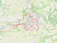
Albi OSM 01.png 1,023 × 782; 574 KB
-
Albi OSM 02.png 925 × 660; 788 KB
-
Albi OSM 03.png 925 × 660; 399 KB
-
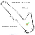
Circuit Albi.svg 2,700 × 2,700; 221 KB
-
Diocèse Albi 1789.svg 2,000 × 1,922; 801 KB
-
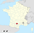
Map commune FR insee code 81004.png 756 × 605; 97 KB
-
Plandureseau-2008.jpg 2,617 × 1,861; 1.06 MB
-
Province d'Albi 1789.svg 2,000 × 1,922; 787 KB
-
Tarn Albigeois.svg 1,009 × 893; 25 KB
-
Transport Albi.png 936 × 535; 35 KB
-
Vicomté d'Albi en 1209.jpg 394 × 188; 89 KB


