Category:Maps of Alberta provincial electoral districts
Jump to navigation
Jump to search
Subcategories
This category has the following 3 subcategories, out of 3 total.
Media in category "Maps of Alberta provincial electoral districts"
The following 10 files are in this category, out of 10 total.
-
 1905albertaelectionbydistrictmap.png 343 × 603; 69 KB
-
 1913ridingmap.png 346 × 565; 49 KB
-
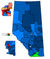
 Alberta Election 2012 Results Map.svg 1,154 × 1,362; 313 KB
-
 Alberta Election Map 2015.svg 1,154 × 1,362; 323 KB
-
 Alberta general election 1971 - Results by Riding.svg 1,211 × 1,362; 245 KB
-
 Alberta general election 1975 - Results by Riding.svg 1,211 × 1,362; 255 KB
-
 Alberta general election 2008 results by riding.svg 1,154 × 1,362; 398 KB
-
 Alberta general election, 2004 results by riding.svg 1,154 × 1,362; 439 KB
-
 Alta2004.PNG 1,088 × 1,300; 29 KB
-
 Alta2008.png 1,088 × 1,300; 32 KB


