Category:Maps of Al-Ahsa Governorate
Jump to navigation
Jump to search
Media in category "Maps of Al-Ahsa Governorate"
The following 11 files are in this category, out of 11 total.
-
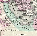
 Colton's Persia Arabia etc (cropped-El Hassa or El Hejer).png 976 × 1,039; 2 MB
-
-
 1914 map of Asia (cropped-El Haza).jpg 221 × 278; 20 KB
-
-
 Al-hasa.png 942 × 732; 1.95 MB
-
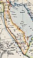 Arabia, Egypt, Nubia and Abyssinia 1883 map (cropped-El Hassa).jpg 757 × 1,324; 1.1 MB
-
 Arabian Peninsula. 12-69. LOC gm70001495 (cropped-al ahsa).jpg 666 × 893; 91 KB
-
 Johnson's Turkey in Asia Persia Arabia etc (cropped-El Ahsa or El Hejer).tif 1,050 × 960; 2.91 MB
-
 Lahsa Eyalet Map 1560-1670.jpg 1,536 × 1,718; 623 KB
-
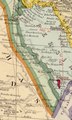
 Stanford's Map of Western Asia (cropped-Hasa).png 948 × 1,278; 2.35 MB
-
 Turkey in Asia, 1909 (cropped-El Hasa).jpg 374 × 485; 49 KB
.png)
.jpg)
.jpg)

.jpg)
.jpg)

.png)
.jpg)