Category:Maps of Aiguillon (Lot-et-Garonne)
Jump to navigation
Jump to search
Wikimedia category | |||||
| Upload media | |||||
| Instance of | |||||
|---|---|---|---|---|---|
| Category combines topics | |||||
| Aiguillon | |||||
commune in Lot-et-Garonne, France    | |||||
| Instance of | |||||
| Location |
| ||||
| Located in or next to body of water | |||||
| Significant event |
| ||||
| Population |
| ||||
| Area |
| ||||
| Elevation above sea level |
| ||||
| Different from | |||||
| official website | |||||
 | |||||
Media in category "Maps of Aiguillon (Lot-et-Garonne)"
The following 12 files are in this category, out of 12 total.
-
 "Le Duche D'Aiguillon - par... Pierre du Val..." (21634542633).jpg 4,062 × 3,108; 2.02 MB
-

-
 Le duche d Aiguillon - CBT 5879986.jpg 5,750 × 4,600; 7.03 MB
-

-
 47004-Aiguillon-argile.jpg 3,057 × 2,480; 641 KB
-
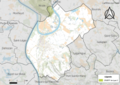
 47004-Aiguillon-Sols.png 3,270 × 2,598; 3.15 MB
-
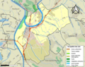
 47004-Aiguillon-ZNIEFF1.png 5,866 × 4,133; 10.21 MB
-
 47004-Aiguillon-ZNIEFF2.png 5,866 × 4,133; 10.21 MB
-
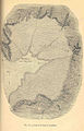 FMIB 35144 Map of the Bay of Aiguillon.jpeg 687 × 1,073; 238 KB
-
 FMIB 43965 Roadstead of Aiguillon.jpeg 878 × 1,227; 479 KB
-
 Le Duche D'Aiguillon.jpg 1,280 × 979; 1.01 MB
-
 Map commune FR insee code 47004.png 756 × 605; 62 KB
.jpg)
.jpg)

.jpg)


