Category:Maps of 6th-century Gauls/Merovingian territory
Jump to navigation
Jump to search
| Preceded by: Maps of Gauls in the 5th-century |
Maps of 6th-century Gauls Maps of 6th-century Merovingian territory 501 AD-600 AD |
Succeeded by: Maps of the Merovingian territory in the 7th-century |
Media in category "Maps of 6th-century Gauls/Merovingian territory"
The following 13 files are in this category, out of 13 total.
-
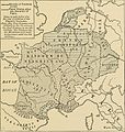 A history of mediaeval and modern Europe for secondary schools (1914) (14597718030).jpg 1,732 × 1,828; 622 KB
-
 D375- Royaumes Mérovingiens sous les fils de Clovis. -liv3-ch2.png 1,446 × 1,570; 164 KB
-
 Division of Gaul - 511.jpg 1,241 × 1,136; 346 KB
-
 Division of Gaul - 561.jpg 1,250 × 1,157; 365 KB
-
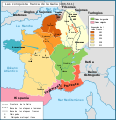
 Division of Gaul - 587.jpg 1,235 × 1,153; 357 KB
-
 France 561 nl.svg 1,845 × 1,665; 594 KB
-
 France 561 ru.svg 1,845 × 1,665; 1.12 MB
-
 France 561-es.svg 1,451 × 1,450; 1.25 MB
-
 La division de la Gaule en 511-es.svg 755 × 784; 156 KB
-
 Le concile d'Agde en 506 de.svg 755 × 784; 589 KB
-
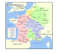
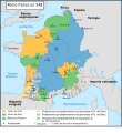 Le royaume des Francs en 548-es.svg 755 × 823; 655 KB
-
 Le royaume des Francs en 556-560-pt.svg 755 × 784; 415 KB
-
 Les conquêtes franques en Gaule (486 - 511)-es.svg 755 × 784; 149 KB
_(14597718030).jpg)


-es.svg)