Category:Maps of 5th-century Italy
Jump to navigation
Jump to search
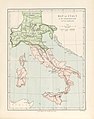
![]() Italy 401-500 CE: Maps showing all or a substantial part of the territory of Italy (the Italian peninsula) as it was in the 5th century.
Italy 401-500 CE: Maps showing all or a substantial part of the territory of Italy (the Italian peninsula) as it was in the 5th century.
| Preceded by: Maps of 4th-century Italy |
Maps of 5th-century Italy 401 - 500 CE |
Succeeded by: Maps of 6th-century Italy |
Media in category "Maps of 5th-century Italy"
The following 2 files are in this category, out of 2 total.
-
 C. 451 Europe.jpg 1,487 × 1,123; 669 KB
-
 238 of '(Italy and her Invaders, Vol. 1-4.)' (11216808023).jpg 2,560 × 3,249; 1.52 MB

%27_(11216808023).jpg)