Category:Maps of 2nd-century BC Iberian Peninsula
Jump to navigation
Jump to search
| Preceded by: Maps of 3rd-century BC Iberian Peninsula |
Maps of 2nd-century BC Iberian Peninsula 200 BC-101 BC |
Succeeded by: Maps of 1st-century BC Iberian Peninsula |
Media in category "Maps of 2nd-century BC Iberian Peninsula"
The following 15 files are in this category, out of 15 total.
-
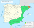
 Campañadeviriato.svg 1,052 × 744; 1.04 MB
-
 Coaliciones y acciones militares celtíberas (221-182 a.C.).svg 707 × 559; 88 KB
-
 Ethnographic Iberia 200 BCE-br.svg 987 × 727; 1.06 MB
-
 Ethnographic Iberia 200 BCE-es.svg 987 × 727; 1.43 MB
-
 Ethnographic Iberia 200 BCE-it.PNG 677 × 630; 55 KB
-
 Ethnographic Iberia 200 BCE.PNG 677 × 630; 59 KB
-
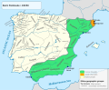
 Iberia 156BC-es.svg 924 × 762; 951 KB
-
 Iberia 156BC-pt.svg 924 × 762; 169 KB
-
 Iberia 156BC.svg 924 × 762; 293 KB
-
 Iberia 196BC-pt.svg 924 × 762; 160 KB
-
 Iberia 196BC.svg 924 × 762; 279 KB
-
 Numantia in Hispania.png 2,484 × 2,048; 1.02 MB
-
 Península Ibèrica 195 aC.png 800 × 555; 68 KB
-
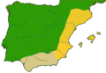
 Provincias de la Hispania Romana (197 a.C.).svg 672 × 537; 14 KB
-
 المقاطعات الرومانية هسبانيا الأقرب (سيتيريور) والأبعد (أوليتير).png 2,467 × 2,048; 136 KB

.svg)


.svg)
_%D9%88%D8%A7%D9%84%D8%A3%D8%A8%D8%B9%D8%AF_(%D8%A3%D9%88%D9%84%D9%8A%D8%AA%D9%8A%D8%B1).png)