Category:Maps of 19th-century Bulgaria
Jump to navigation
Jump to search
| Preceded by: Maps of 18th-century Bulgaria |
Maps of 19th-century Bulgaria 1801 AD-1900 AD |
Succeeded by: Maps of 20th-century Bulgaria |
Media in category "Maps of 19th-century Bulgaria"
The following 16 files are in this category, out of 16 total.
-
 1875-1876.jpg 968 × 725; 126 KB
-
 Constantinople conference west.jpg 2,000 × 3,804; 1.88 MB
-
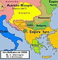
 AtlBalk1880.jpg 318 × 327; 153 KB
-
 AtlBalk1890.jpg 318 × 327; 157 KB
-
 Balkan boundaries1876map1914.png 984 × 712; 73 KB
-
 Bulgaria after Congress of Berlin in 1878.png 4,148 × 2,896; 552 KB
-
 Bulgaria after unification political map-bg.svg 2,256 × 1,800; 3.01 MB
-
 Bulgaria after unification political map-de.svg 1,131 × 904; 2.43 MB
-
 Bulgaria after unification political map-en.svg 2,256 × 1,800; 3.01 MB
-
 Bulgaria after unification political map-es.svg 2,256 × 1,800; 3.77 MB
-
 Bulgaria San Stefano Berlin 1878 1885 TB.png 1,765 × 1,703; 440 KB
-
 Bulgaria San Stefano Berlin 1878 TB He.png 1,765 × 1,703; 376 KB
-
 Bulgaria San Stefano Berlin 1878 TB.png 1,765 × 1,703; 449 KB
-
 C. 1893 Southeastern Europe and Asia Minor (1683-1893).jpg 2,123 × 1,368; 1.81 MB
-
 Constantinople conference east.jpg 2,000 × 3,752; 1.73 MB
-
 Constantinople conference.png 3,741 × 2,612; 505 KB


.jpg)

