Category:Maps of 18th-century Spain
Jump to navigation
Jump to search
| Preceded by: Maps of 17th-century Spain |
Maps of 18th-century Spain 1701 AD-1800 AD |
Succeeded by: Maps of 19th-century Spain |
Media in category "Maps of 18th-century Spain"
The following 11 files are in this category, out of 11 total.
-
 423 of 'England under Stuart Rule, etc' (11246609713).jpg 1,904 × 1,267; 606 KB
-
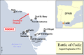 Battle of Cadiz 1702.PNG 682 × 447; 46 KB
-
 Ciudades con voto en las Cortes de Madrid de 1789.svg 2,043 × 1,753; 1.04 MB
-
 Densidades de población en España (1787).png 779 × 529; 163 KB
-
 Densidades de población en España (1787).svg 568 × 387; 1.49 MB
-
 Ensenada1759.svg 889 × 755; 749 KB
-
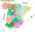 España Finales Del XVIII.svg 1,154 × 1,044; 187 KB
-
 Map Spain 1720.png 482 × 390; 47 KB
-
 Señoríos del Reino de Córdoba.svg 588 × 783; 544 KB
-
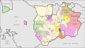 Señoríos del Reino de Jaén.svg 913 × 520; 671 KB
-
 Señoríos del Reino de Sevilla.svg 1,144 × 1,041; 1.88 MB
.jpg)


.png)
.svg)


