Category:Maps of 16th-century Iberian Peninsula
Jump to navigation
Jump to search
Iberian Peninsula (territory of present-day ![]() Spain and
Spain and ![]() Portugal) in 1501-1600 CE: Maps showing all or a substantial part of the Iberian Peninsula as it was in the 16th century.
Portugal) in 1501-1600 CE: Maps showing all or a substantial part of the Iberian Peninsula as it was in the 16th century.
| Preceded by: Maps of 15th-century Iberian Peninsula |
Maps of 16th-century Iberian Peninsula 1501 - 1600 CE |
Succeeded by: Maps of 17th-century Iberian Peninsula |
Subcategories
This category has the following 2 subcategories, out of 2 total.
P
S
Media in category "Maps of 16th-century Iberian Peninsula"
The following 12 files are in this category, out of 12 total.
-
 (Spruner-Menke, map 19) The Iberian peninsula at the start of the 16th century.jpg 3,363 × 2,776; 2.45 MB
-
 C. 1513 Iberian Peninsula.jpg 4,000 × 3,000; 4.38 MB
-
 Péninsule ibérique en 1516.png 2,000 × 1,500; 1.01 MB
-
 Corona Castilla detallado.png 1,580 × 1,313; 178 KB
-
 Habsburg Map 1547.jpg 1,654 × 1,029; 534 KB
-
 Péninsule ibérique en 1556.png 2,000 × 1,500; 974 KB
-
 C. 1560 Spain and Portugal.jpg 1,126 × 1,048; 1.16 MB
-
 Péninsule ibérique en 1598.png 2,000 × 1,500; 771 KB
-

-
 Spruner-Menke Handatlas 1880 Karte 19.jpg 10,441 × 8,689; 22.62 MB
-
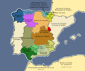
 Reinos Antiguo Régimen.svg 749 × 549; 225 KB
-
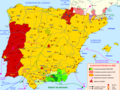
 Revueltas antiseñoriales castellanas en 1520-1521.png 781 × 653; 105 KB
_The_Iberian_peninsula_at_the_start_of_the_16th_century.jpg)


.jpg)


