Category:Maps of 14th-century Africa
Jump to navigation
Jump to search
English: Modern maps showing the history of Africa. Not to be confused with genuinely old 14th-century maps of Africa
Subcategories
This category has the following 4 subcategories, out of 4 total.
M
- Maps of the Adal Sultanate (14 F)
- Maps of the Hafsid dynasty (22 F)
- Maps of the Marinid dynasty (25 F)
- Maps of the Zayyanid dynasty (27 F)
Media in category "Maps of 14th-century Africa"
The following 21 files are in this category, out of 21 total.
-
 East Africa, c.1500.jpg 736 × 1,074; 86 KB
-
 Sultanate of Kilwa.png 1,819 × 2,739; 1.57 MB
-
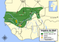
 The Mali Empire.jpg 3,000 × 2,250; 3.07 MB
-
 Mapa Império do Mali pt.png 2,993 × 2,139; 799 KB
-
 Pate sultanate.png 1,364 × 2,071; 961 KB
-
 Africa - Vèrs la mitat dau sègle XIV.png 606 × 683; 86 KB
-
 Chewa.png 850 × 850; 275 KB
-
 Conquests of Amda Seyon.png 1,280 × 905; 96 KB
-
 Ethiopia 1400.svg 1,052 × 744; 3.55 MB
-
 Ethiopia 1500.svg 1,052 × 744; 3.53 MB
-
 Medieval Ethiopia Extent.png 514 × 514; 65 KB
-
 Mereb Melash.png 17,877 × 20,000; 4.22 MB
-
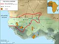
 Niger saharan medieval trade routes.PNG 817 × 326; 263 KB
-
 Occ-Mus-14e-b.PNG 699 × 379; 16 KB
-
 Sultanate of Ifat.png 1,648 × 1,349; 116 KB
-
 The Sultanate of Ifat.png 3,527 × 3,503; 827 KB
-
 Tunni Sultanate map.png 536 × 600; 68 KB
-
 Índico e rota da Seda século XIV.png 800 × 800; 357 KB
-
 Índico e rota da Seda século XIV.svg 800 × 800; 690 KB
-
 سلطنة كلوة.png 1,819 × 2,739; 1.68 MB
-
 ইবনে বতুতা আফ্রিকা.png 657 × 617; 185 KB


