Category:Maps of 13th-century Arabia
Jump to navigation
Jump to search
Media in category "Maps of 13th-century Arabia"
The following 6 files are in this category, out of 6 total.
-
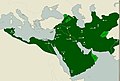 Abbasid map 1290 الخريط العباسية.jpg 726 × 491; 113 KB
-
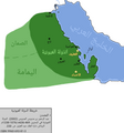
 Map of the Usfurids.jpg 3,430 × 4,085; 385 KB
-
 Map of Usfurid Emirate.png 9,779 × 8,280; 3.15 MB
-
 Map of Uyunid Emirate.png 3,737 × 4,000; 579 KB
-
 More accurate map of the Usfurids.jpg 4,094 × 4,447; 432 KB
-
 Usfurids invades Bisha.png 5,000 × 5,000; 1.29 MB


