<nowiki>Category:Maps of Östergötland County; Kategori:Kartor över Östergötlands län; categoría de Wikimedia; kategori Wikimedia; Wikimedia category; د ويکيمېډيا وېشنيزه; Vikimedya kategorisi; ویکیمیڈیا زمرہ; kategória projektov Wikimedia; категорія проєкту Вікімедіа; 维基媒体分类; Wikimedia-Kategorie; kategorie na projektech Wikimedia; kategorija na Wikimediji; विकिपीडिया:श्रेणी; page de catégorie de Wikimedia; kategorija na Wikimediji; विकिपीडिया वर्ग; категорија на Викимедији; Wikimedia-Kategorie; Wikimedia-kategori; kategori Wikimédia; تصنيف ويكيميديا; pajenn rummata eus Wikimedia; Wikimedia:ကဏ္ဍခွဲခြင်း; 維基媒體分類; Wikimedia категориясы; categoría de Wikimedia; categoria de Wikimedia; Wikimedia-Kategorie; tudalen categori Wikimedia; kategori e Wikimedias; ردهٔ ویکیپدیا; 维基媒体分类; Wikimedia-kategory; ვიკიპედია:კატეგორიზაცია; ウィキメディアのカテゴリ; categoria Wikimedia; تصنيف بتاع ويكيميديا; විකිමීඩියා ප්රභේද පිටුව; categoria Vicimediorum; विकिमीडिया श्रेणी; Wikimedia-luokka; Wikimedia category; guruhi Vikimedia; катэгорыя ў праекце Вікімэдыя; Викимедиа проектындагы төркем; catigurìa di nu pruggettu Wikimedia; หน้าหมวดหมู่วิกิมีเดีย; Wikimedia:Kategorija; Wikimedia-Kategorie; Wikimedia:Klassys; категория на Уикимедия; categorie a unui proiect Wikimedia; categurìa 'e nu pruggette Wikimedia; Wikimedia-kategori; kawan Wikimèdia; гурӯҳи Викимедиа; 위키미디어 분류; Wikimedia-bólkur; kategorio en Vikimedio; kategori Wikimedia; Wikimedia:Ronnaghys; উইকিমিডিয়া বিষয়শ্রেণী; kategori Wikimedia; 维基媒体分类; וויקימעדיע קאַטעגאָריע; kategorija w projektach Wikimedije; thể loại Wikimedia; Wikimedia projekta kategorija; Wikimedia-kategorie; categoria de um projeto da Wikimedia; 维基媒体分类; категорияд Ангилал; Wikimedia-kategori; kategori Wikimedia; پۆلی ویکیمیدیا; Wikimedia category; Vikimédia ñemohenda; Wikimédia-kategória; વિકિપીડિયા શ્રેણી; Wikimediako kategoria; категория в проекте Викимедиа; Wikimedia-Kategorie; Kategoriya ning Wikimedia; Wikimedia-kategorie; Wîkîmediya:Kategorî; विकिमिडिया श्रेणी; Wikimedia-Kategorie; קטגוריה במיזמי ויקימדיה; Викимедиа проектындагы төркем; 维基媒体分类; विकिमिडिया श्रेणी; 維基媒體分類; Wikimedia-kategoriija; гурӯҳи Викимедиа; 維基媒體分類; categoría de Wikimedia; Viciméid catagóir; categoria di un progetto Wikimedia; Wikimedia category; kategoria w projekcie Wikimedia; Wikimedia-kategori; Wikimedia kategooria; 維基媒體分類; Վիքիմեդիայի նախագծի կատեգորիա; Викимедиа категорияһы; kategorya ng Wikimedia; ẹ̀ka Wikimedia; 維基媒體分類; categoria de um projeto da Wikimedia; Викимедиина категорија; Wikimedia-Kategorie; tumbung Wikimedia; Wikimedia-Kategorie; kategorija Wikimedie; Wikimedia proyektındağı törkem; kategoria ti Wikimedia; катэгорыя ў праекце Вікімедыя; kategori Wikimedia; jamii ya Wikimedia; വിക്കിമീഡിയ വർഗ്ഗം; Wikimedia-categorie; kategori Wikimedia; Wikimedia-categorie; زمرو:وڪيپيڊيا زمرا بندي; Vikipidiya:Shopni; categoría de Wikimedia; Wikimedia-categorie; κατηγορία εγχειρημάτων Wikimedia; விக்கிமீடியப் பகுப்பு</nowiki>
Subcategories
This category has the following 7 subcategories, out of 7 total.


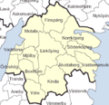 Östergötland County.png 564 × 545; 21 KB
 Svcmap Ostergotland.png 192 × 400; 8 KB
 SverigesLän2007Östergötland.svg 287 × 606; 73 KB
 Admiralty Chart No 3499 Norrkoping Bight Landsort to Haradskar, Published 1965.jpg 16,399 × 11,275; 21.27 MB
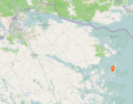 Aspoja map.png 1,582 × 1,244; 1.98 MB
 Aspoja.png 1,350 × 1,304; 383 KB
 Kommunkarta1952 Östergötland.png 3,225 × 3,109; 222 KB
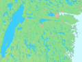 La2-demis-ostergotland.png 810 × 617; 108 KB
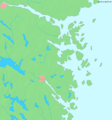 La2-demis-st-anna.png 684 × 731; 55 KB
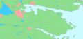 La2-demis-vikbolandet.png 1,022 × 489; 53 KB
 Ostergotland 100.png 1,168 × 826; 2.06 MB
 Socknar - Finspångs kommun.png 924 × 950; 14 KB
 Twin Cities of Sweden ver.2.PNG 493 × 563; 45 KB
 Östergötland County (Riksdag constituency).svg 2,000 × 4,552; 599 KB
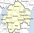 Östergötland County – UK – Лен Естерйотланд.png 564 × 545; 19 KB
 Östgötaskärgården karta.png 591 × 768; 418 KB


.svg)

