Category:Maps of Île de la Cité
Jump to navigation
Jump to search
Wikimedia category | |||||
| Upload media | |||||
| Instance of | |||||
|---|---|---|---|---|---|
| Category combines topics | |||||
| île de la Cité | |||||
island in the river Seine, Paris, France    | |||||
| Instance of | |||||
| Location | |||||
| Located in or next to body of water | |||||
| Width |
| ||||
| Length |
| ||||
| Population |
| ||||
| Area |
| ||||
| Drainage basin | |||||
 | |||||
Subcategories
This category has the following 2 subcategories, out of 2 total.
N
O
Media in category "Maps of Île de la Cité"
The following 18 files are in this category, out of 18 total.
-
 Île de la Cité and Île Saint-Louis - OSM 2021.svg 2,260 × 1,271; 1.26 MB
-
 Paris in 9th century.jpg 1,289 × 975; 143 KB
-
 Canal Saint-Martin, Paris - OSM 2022.svg 1,694 × 2,206; 7.59 MB
-
 Ile de la Cite map lang hu.jpg 1,172 × 824; 419 KB
-
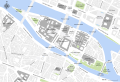
 Map of Île de la Cité - OpenStreetMap 2015.svg 2,000 × 1,050; 678 KB
-
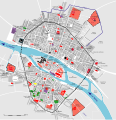
 Map of Île de la Cité with monuments - OpenStreetMap 2015.svg 2,401 × 1,637; 564 KB
-
 Paris - Enceinte gallo-romaine.svg 2,120 × 1,455; 1.5 MB
-
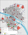
 Paris - Île de la Cité 2011.svg 2,670 × 1,841; 5.05 MB
-
 Plan de Paris vers 1300-1330 - ALPAGE.svg 2,430 × 2,506; 443 KB
-
 Plan de Paris vers 1300-1330.svg 546 × 692; 408 KB
-
 Plan restitué de Paris en 1380 - ALPAGE.svg 2,403 × 2,570; 511 KB
-
 Plan restitué de Paris en 1380.svg 544 × 689; 460 KB
-
 Tracé de l'enceinte de Philippe Auguste - ALPAGE.svg 1,467 × 1,070; 820 KB
-
 Tracé de l'enceinte de Philippe Auguste - H. Noizet, A.-L. Bethe.svg 1,456 × 1,059; 1.04 MB
-
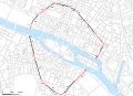
 Wall of Charles V - OSM 2020.svg 2,200 × 1,600; 4.08 MB
-
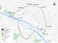
 Wall of Philip II Augustus - OSM 2020.svg 1,500 × 1,300; 2.23 MB
-
 Île de la Cité, Île Saint-Louis.png 2,100 × 1,300; 52 KB
-
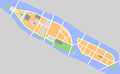
 Île de la Cité.png 1,409 × 1,017; 57 KB


