Category:Maps of Île de Batz
Jump to navigation
Jump to search
Media in category "Maps of Île de Batz"
The following 8 files are in this category, out of 8 total.
-
 29082-Île-de-Batz-Sols.png 3,270 × 2,598; 849 KB
-
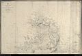
 Admiralty Chart No 2745 France, north coast, Ile de Bas and adjacent coast, Published 1860.jpg 11,528 × 7,705; 45.97 MB
-

-
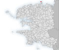 Map-France-Finistère-Commune-Île-de-Batz.svg 1,468 × 1,246; 209 KB
-
 Carte ancienne île de Batz.jpg 1,000 × 683; 180 KB
-
 Die Gartenlaube (1876) b 267 1.jpg 1,578 × 1,606; 1.72 MB
-
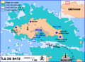 Ile-de-Batz.png 703 × 518; 24 KB
-
 Map commune FR insee code 29082.png 756 × 605; 55 KB


.jpg)


_b_267_1.jpg)

